Metro areas and other maps
- Dosdedos Metropolitan Area
- Dosdedos State unfinished concept
- Dosdedos two unfinished first attempts
- Hello Peninsula
- Fictional city divided by three borders
- Coastal City
- Sandgate Region and Vanbaren Micronation
- Tomua Lake County
- Fake Adelaide-Melbourne Duopolis
- Tiny fake Dubrovnik
- Walled city with lake
- Tiny 3D city doodle
- Tiny village map
- Unnamed city on peninsula
- Paris/Rome like city
- Fictional country based on Andalusia
- Tomaz Minoria and Eruazia countries
Islands
Map projects
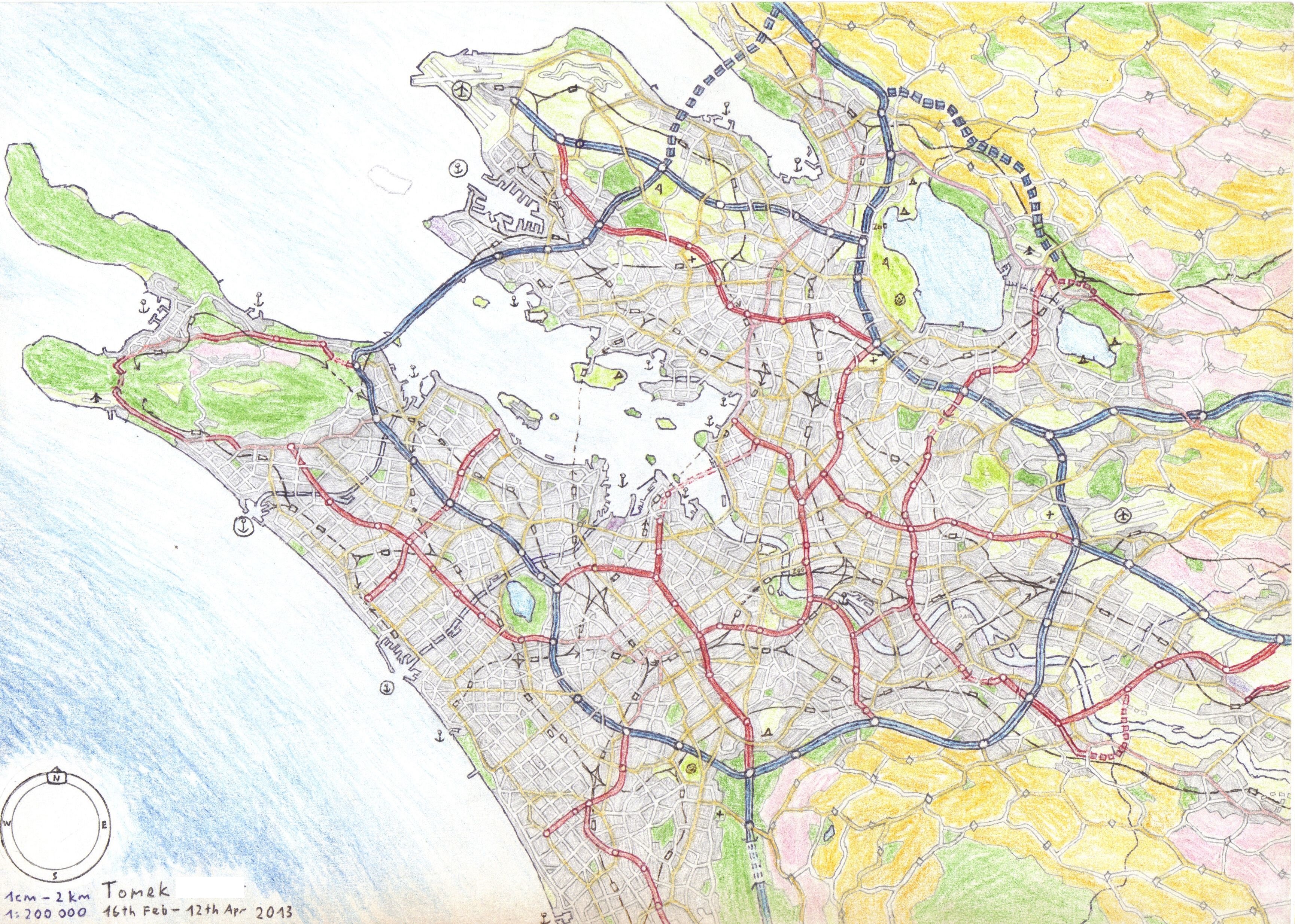
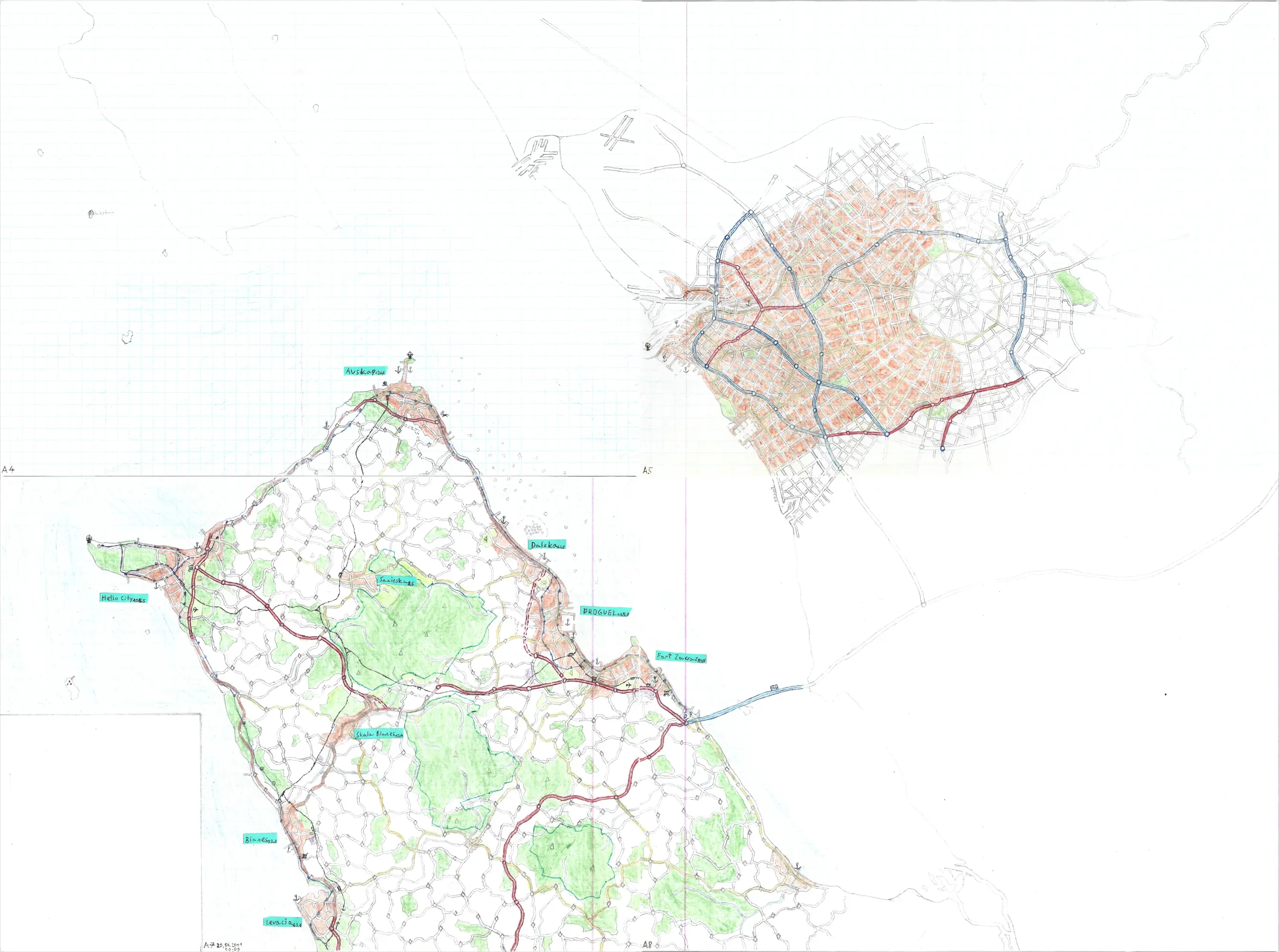
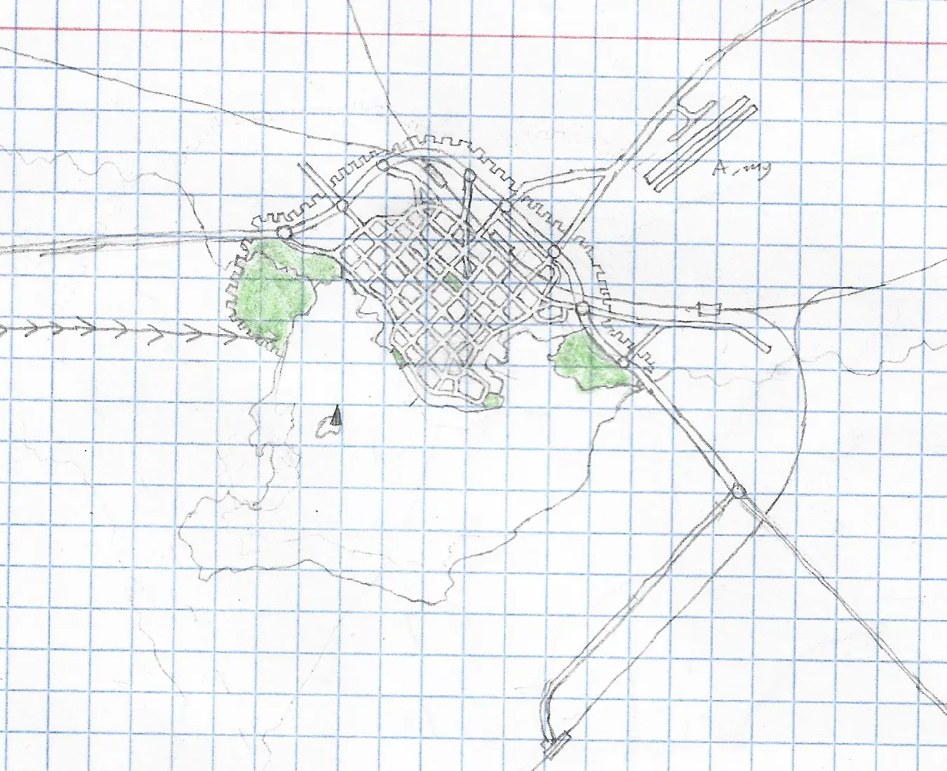
Dosdedos Metropolitan Area
I used to draw some doodles and maps, but for a long time as I'm
getting older I lose my creativity and patience to hand drawn stuff
but this one from 2013 is still my absolute favourite fictional map
I've ever made! Fun Fuct: 'Dos Dedos' means "Two Fingers" in Spanish
as the whole area gets its name from these two westernmost peninsulas
which on the map look very much like the index finger and the thumb
making measuring gesture :D.
Created: 16th February -
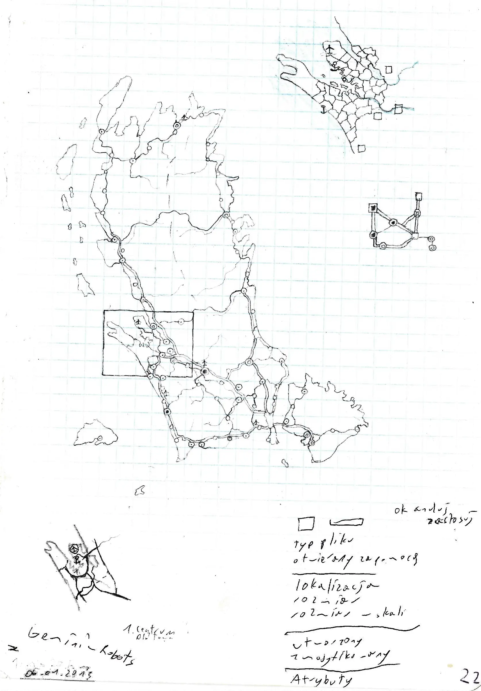
Dosdedos State concept and doodles
When I had a plan for a metropolitan area with interesting coastline
and attractive terrain that was particularly good I tried to make the
entire country adjacent to it. I've never finished a single one, but
at least the map of the metro area itself was finished. But that
archipelago with the shape inspired by Portugal is nice indeed. Oh and
I see what song I listened back then: 'Gemini - Robots', good
times.
Created:
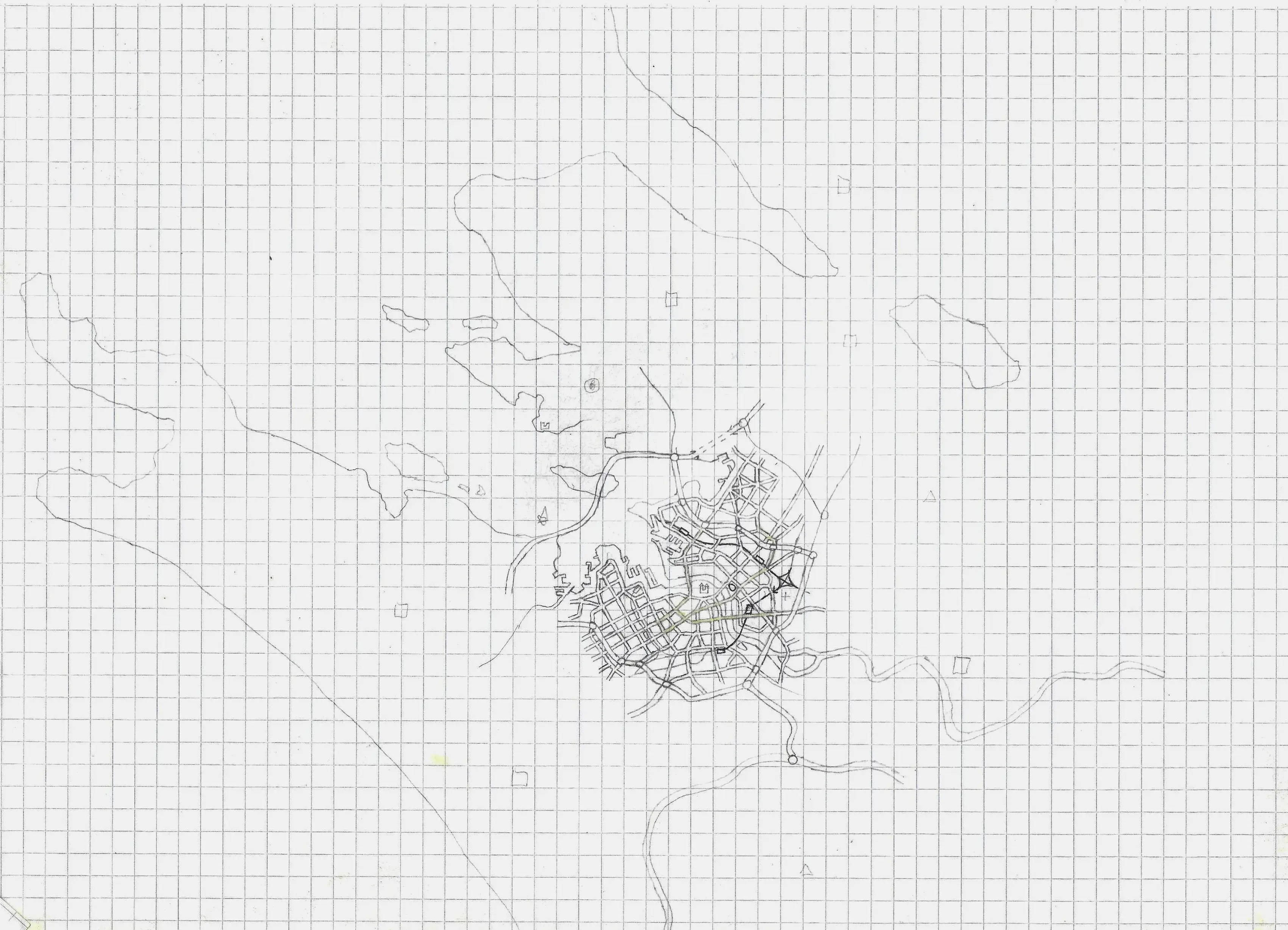
Dosdedos unfinished first attempts
Sometimmes it took me two or more attempts to make a metro area with
the certain features. That try hadn't been finished, I don't see why
but maybe that's better because the successful map has been drawn on
gridless paper so it looks less like a school doodle.
Created:
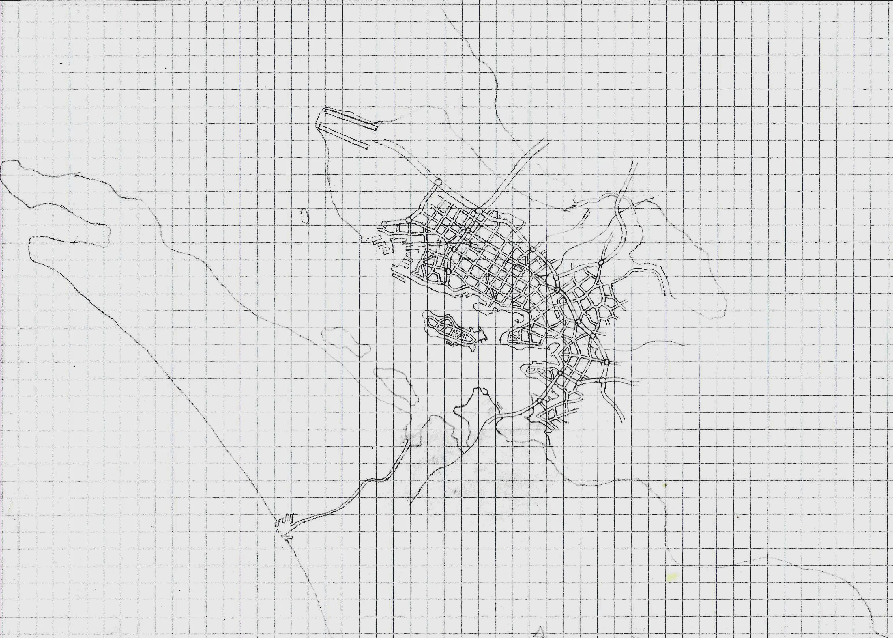
Hello Peninsula (and unfinished large
city on the eastside)
As you can see I hardly ever fill the entire pages and it hinders a
great potential for cool looking maps. However, I cringe a little
about those tiny islands scathered near the east coast of the
peninsula, as they look so unrealistic and were inspired by the hype
around artificial islands of Dubai, which I was guilty of falling into
it.
Created:
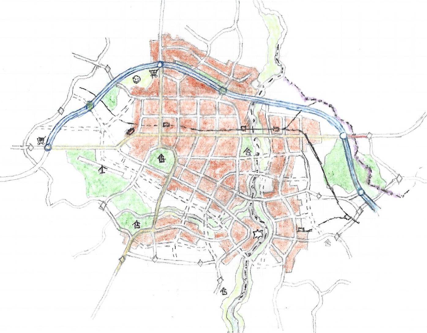
Fictional urban area divided by three borders
Continiuous urban areas divided by important borders like Berlin (back
in the days), Nicosia, Detroit - Windsor, El Paso - Ciudad Juarez or
Hong Kong - Shenzhen are kinda fascinating as how the practical
solutions to infrastructure and transport have to overcome different
political regimes. The layout of the city was partially inspired by my
hometown of Zamość, Poland.
Created: no date
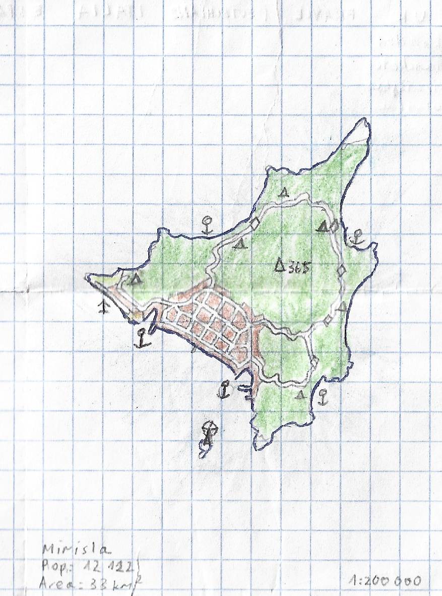
Mirisla Island
That's a tiny map that I've drawn days before I went to a trip to
Croatia. Maps of Dalmatia with its many islands and villages was an
inspiration.
Created:
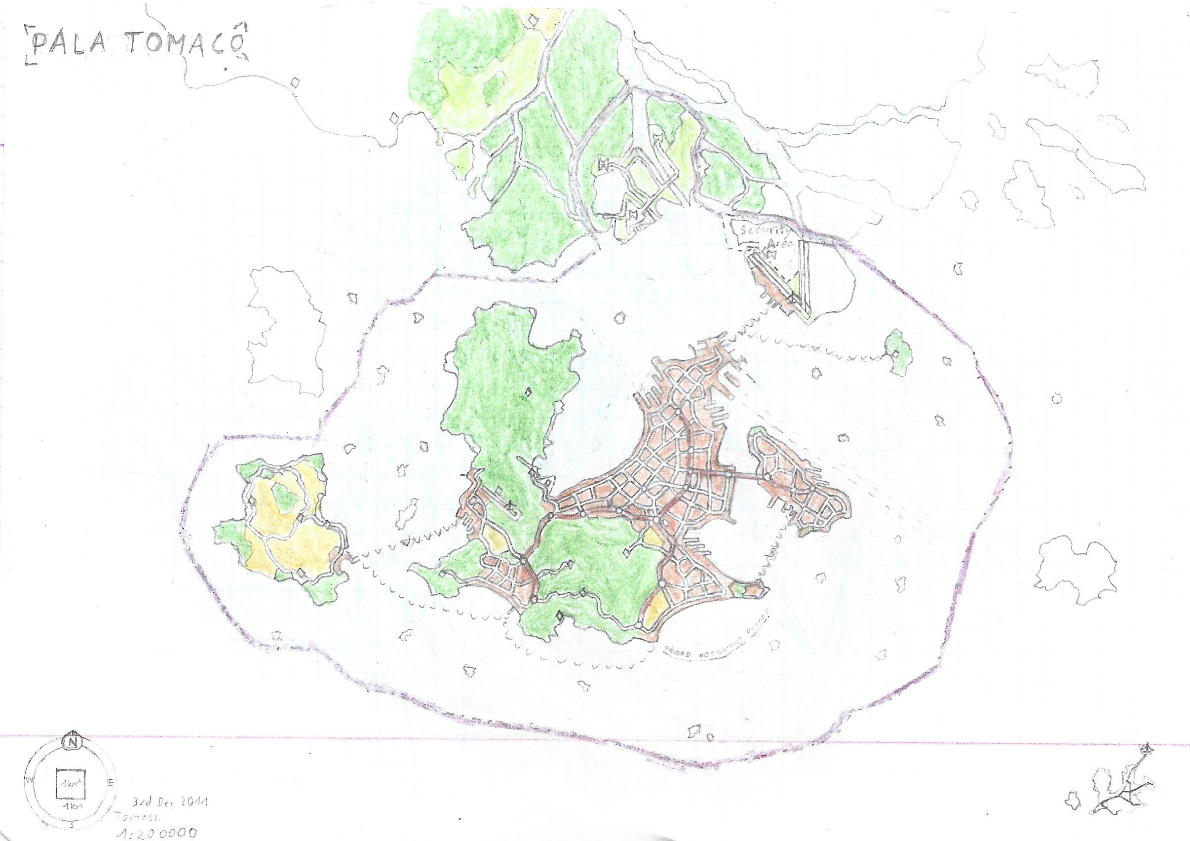
The Independent City of Pala Tomaco
I also like to draw some tiny city-states, although I usually don't
finish them either. That city is an independent island country that is
almost bordering the larger state up north, just like Singapore and
Malaysia that was my inspiration at that time.
Created:
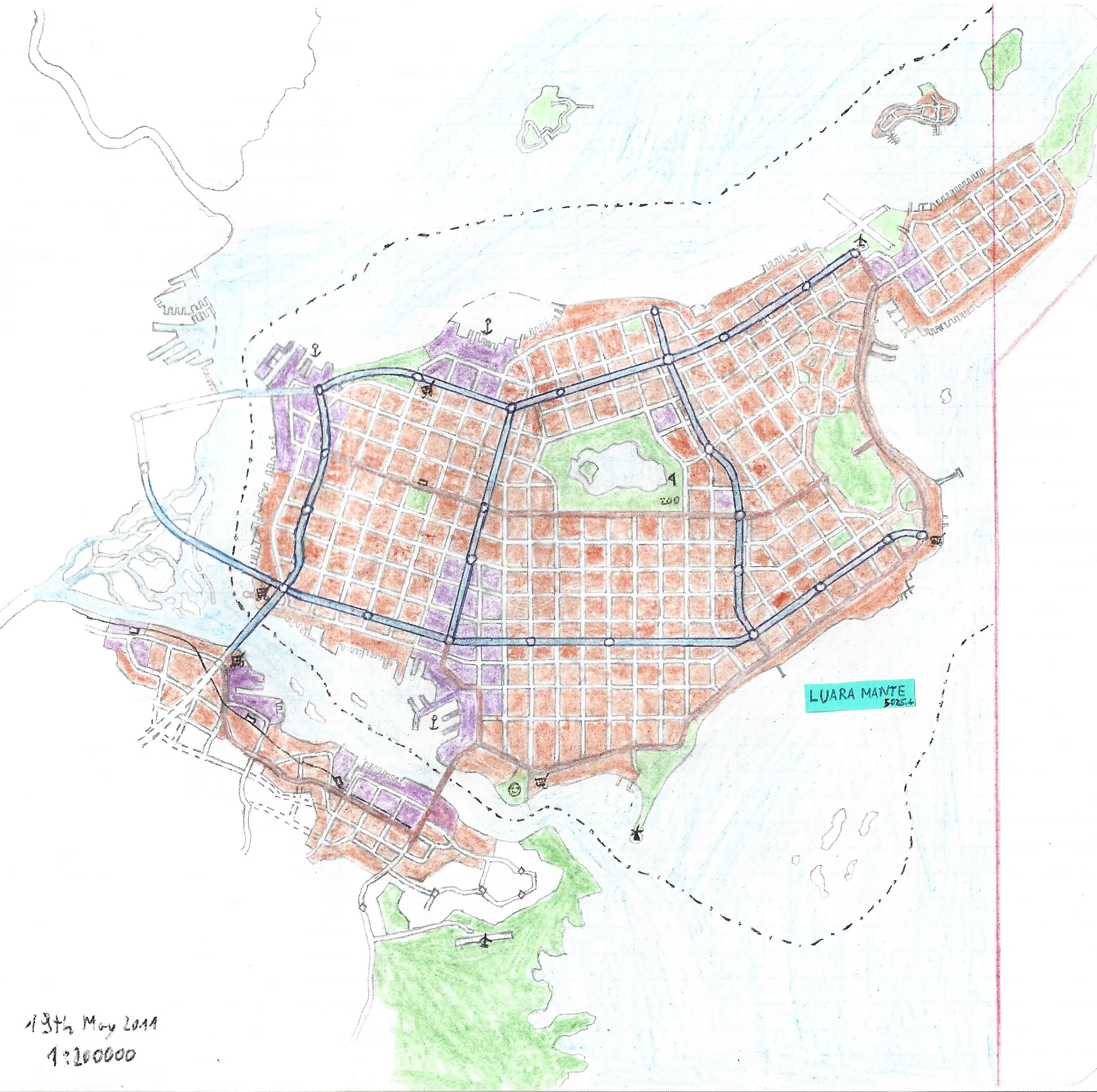
The Autonomous City of Luara Mante
The metropolis of about 5 million citizens placed on an island
that is a mixture of miniaturized Cyprus and Xiamen in Fujian,
China
Created:
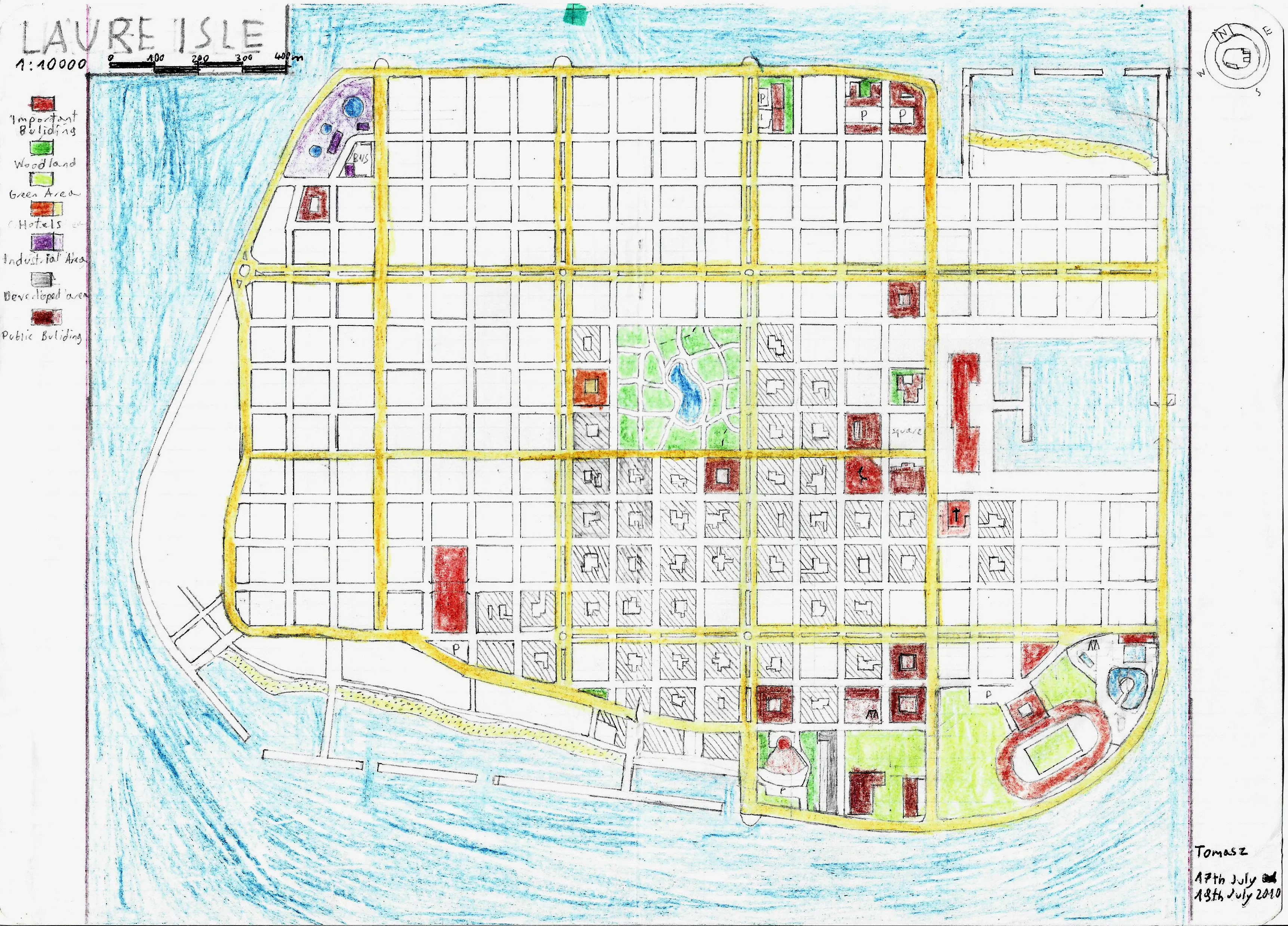
Laure Isle
I like the name Laura
and named some places in my imaginary maps. This island was inspired
by densely packed island of Male, the capital of Maldives that got
full storm protection walls around the island from Japanese.
Created:
Unnamed Island Nation 1
This tiny island was created during my fascination of small British
dependencies, like Isle of Man, Jersey, Bermuda and so on. I can
recall that the shape of the island is very much inspired by Moldova,
as I was fascinated by that country by that times simply because it's
very close to Poland (but without common border except like 400 years
ago) and barely anyone tought anything about that country in school. I
guess the second smaller island is Chad shaped tho.
Created:
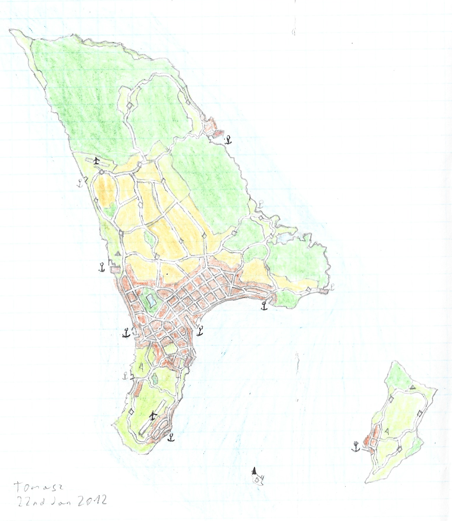
Unnamed Island Nation 2
And this one is slightly smaller. The map also includes some
topographic contours as the island is much more hilly than the
previous one.
Created:
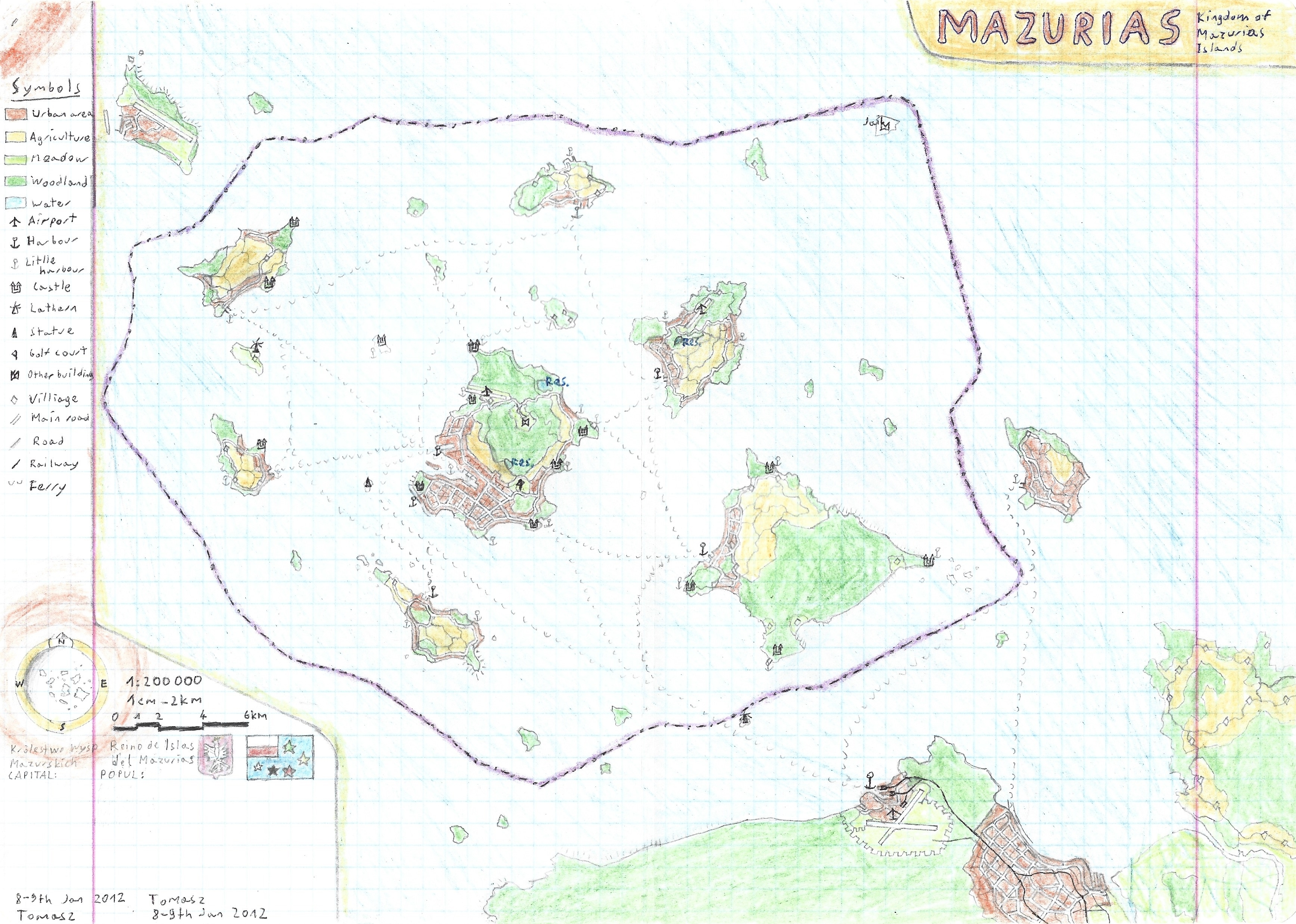
Kingdom of Mazurias Islands
Creating some tiny fictional states was my hobby for a long time, with
additional flags and statistics. That is a fictional archipelago
formerly colonized by Poland.
Created: 8th January -
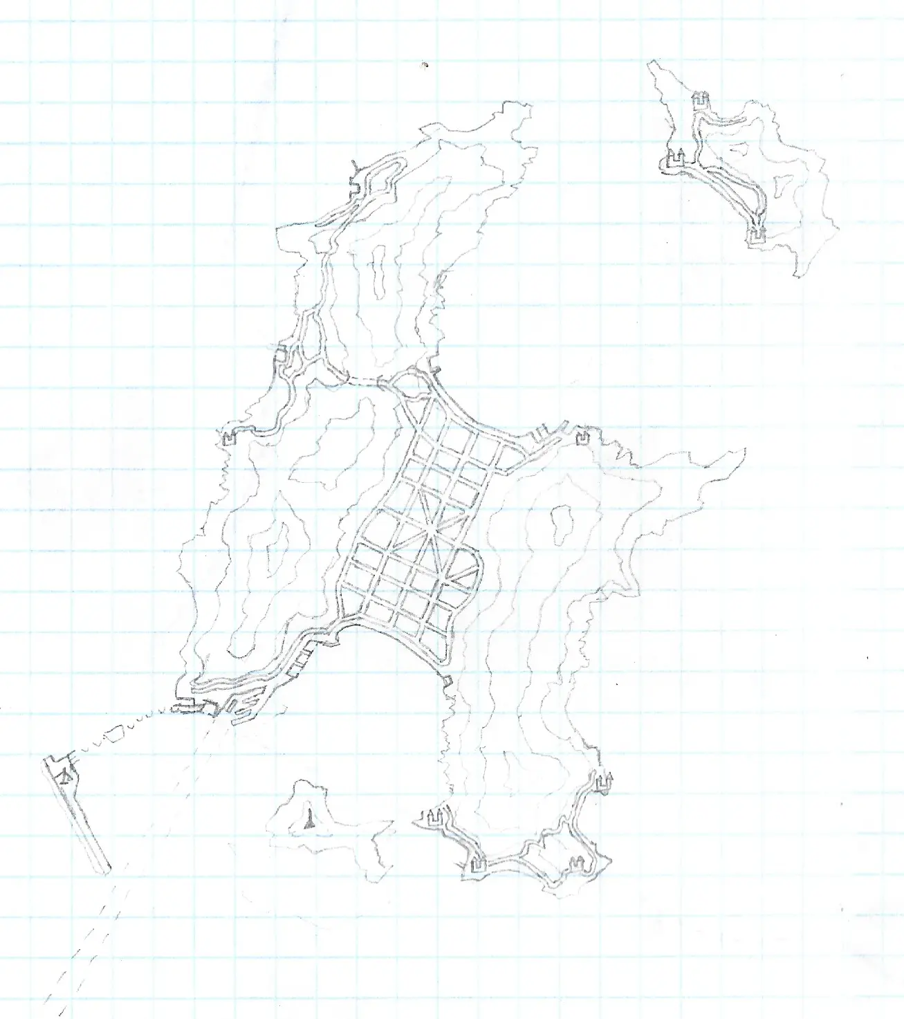
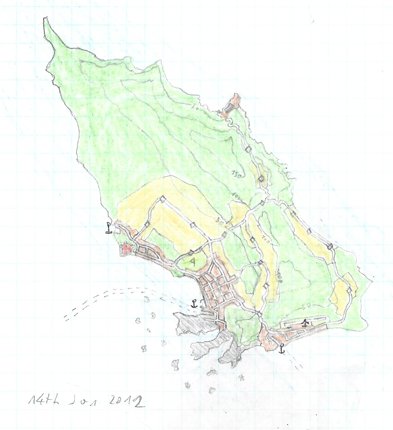
Unnamed Island Nation 3
Yet another unnamed city on the island, this time nested between two
small mountain ranges. The city seems to be unusually large and
artificially planned. I really like that coastline and the idea for an
island micronation is pretty neat, why I didn't finished it I don't
know. But maybe that blank space is an oportunity to revive this map,
I have some plans to finished that map with the more digital and even
interactive spin.
Created: no date
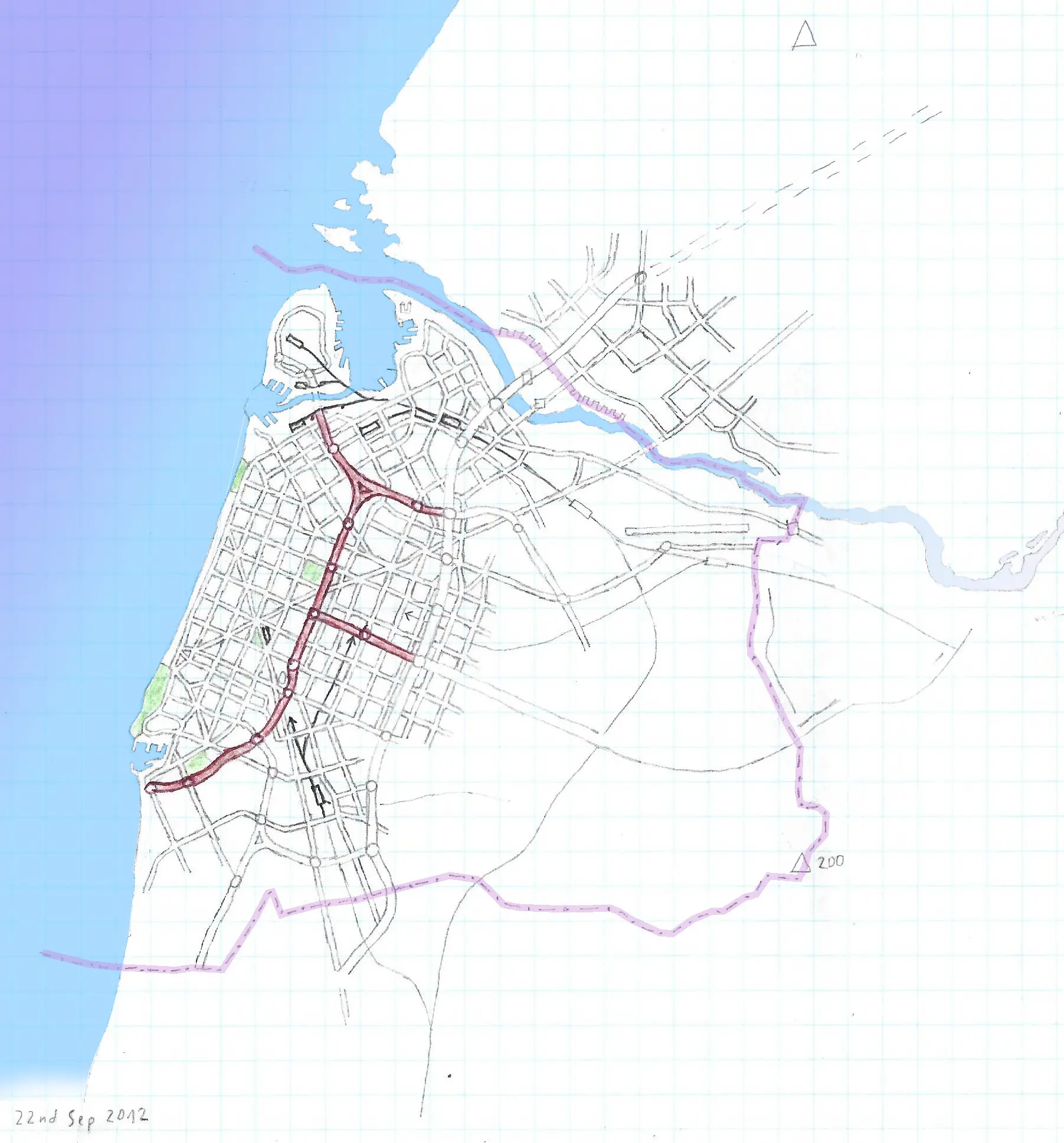
Unnamed Coastal City
I really regret that I hadn't finished that map, so for the sake of
visibility I added with GIMP water bodies gradient and marked the
border with the purple line as it supposed to be city-state or at
least autonomous city. Batumi in Georgia (country) and the region of
Adjaria was the inspiration.
Created:
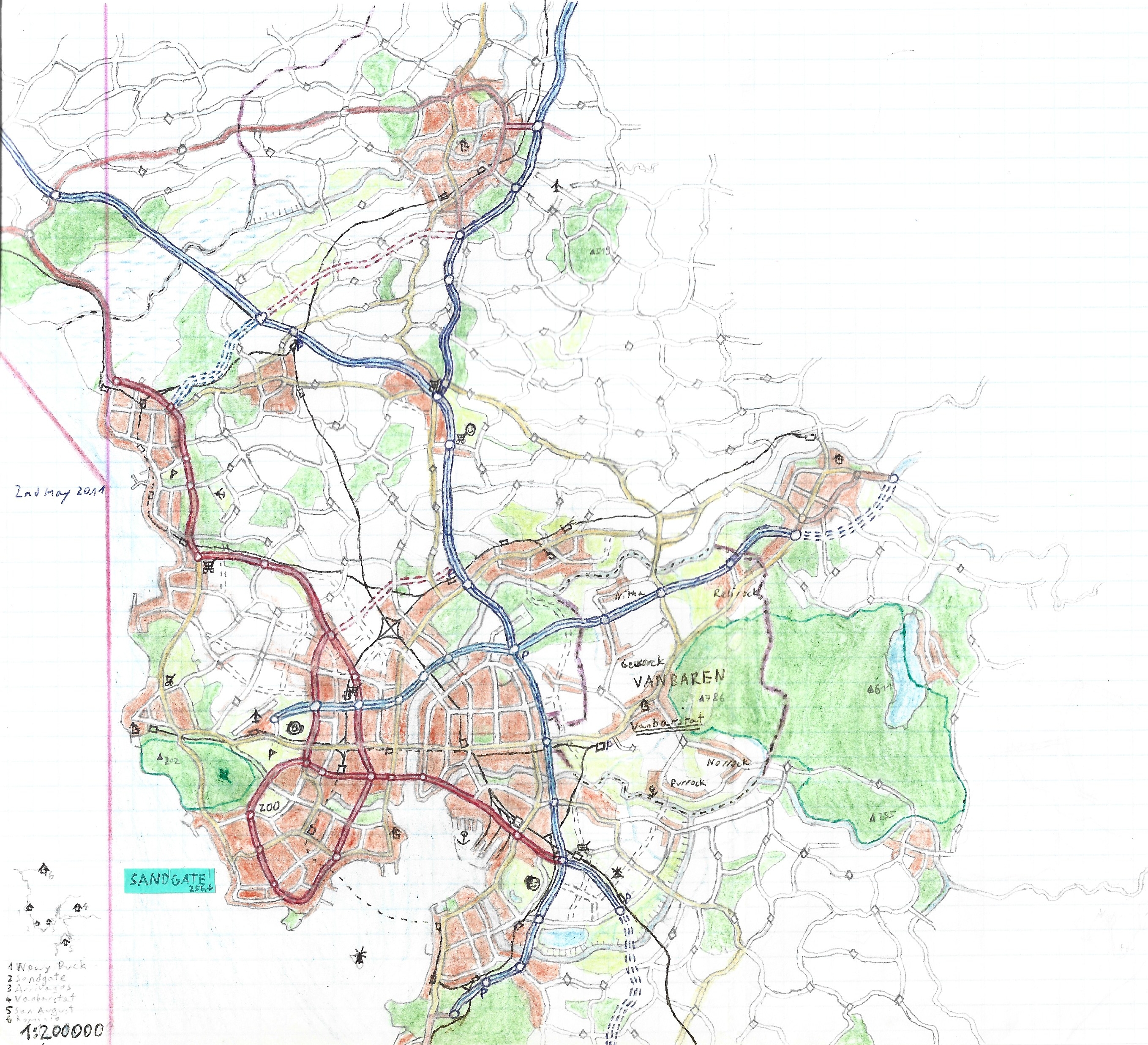
Sandgate Region and Vanbaren Micronation
Another example of my fascination about small states, this time the
inspiration was San Marino, which is a tiny independent republic near
the coast but not touching it and is next to a city that is much more
populated than the state itself, in case of San Marino it's Rimini, in
case of Vanbaren, the city of Sandgate.
Created:
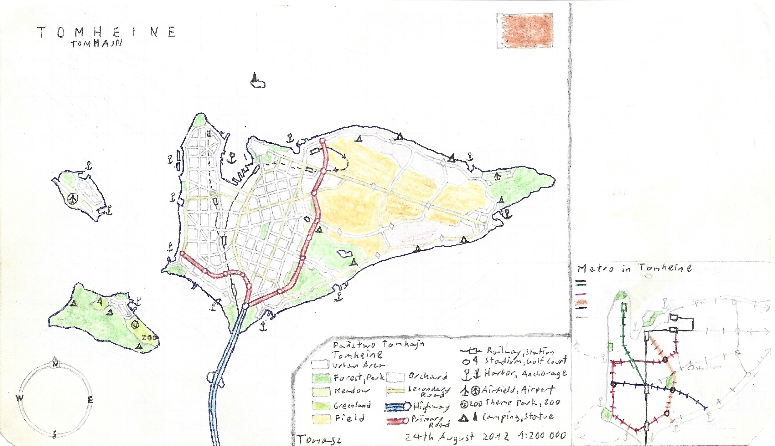
The State of Tomhein
This state was inspired by an almost city-state of Bahrain with
suspiciously similar flag an the name.
Created:
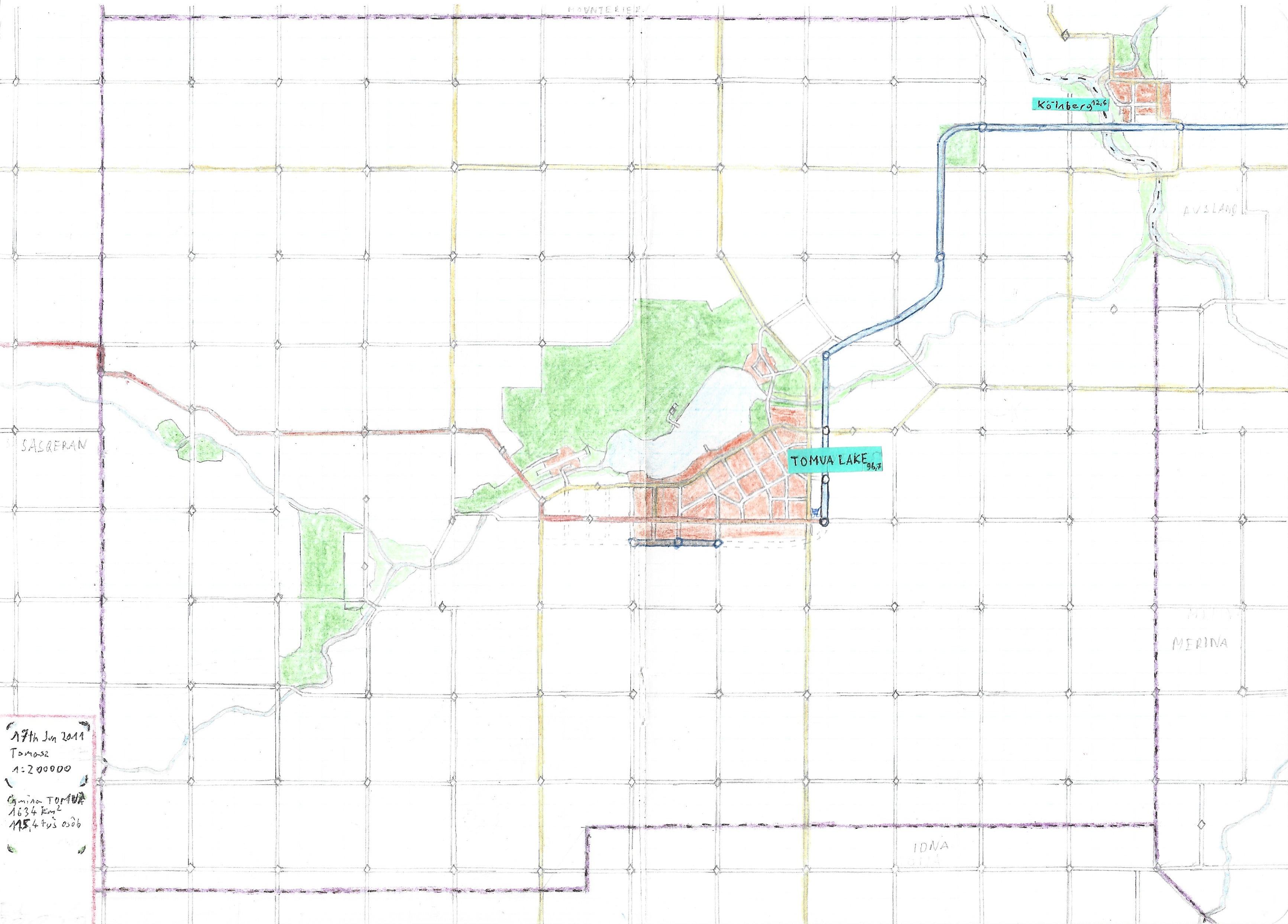
Tomua Lake County
Whether am I an egomaniac or just plainly not that creative, I just
couldn't help but name some prominent fictional places by some
distorted version of my real name. Here's the map of county inspired
by all those squarish US counties with endless grids of mile by mile
fields.
Created:
Fake Adelaide-New York Duopolis
Once upon a time I was roaming around Australian cities on the map and
I came across Adelaide and I've liked the topography of that city, so
I've designed my interpretation of that city and added my takeoff of
Manhattan and parts of Long Island on the east. Some elements of the
eastern part of the duopolis were inspired by Melbourne, as it was
also meant as my silly "fanfiction" of what would happen if Adelaide
and Melbourne were that close to each other, the New York part went
just natural as I know its basic topography much better than
Melbourne.
Created:
Tiny fake Dubrovnik
That's my later attempt to create compact dense old city inspired by
Dubrovnik, but really it more of a modern city with medieval fortress
next to the bay. On the right top corner there is a larger scale
outline of the city with visible railway that supposed to stop on the
western seaport. As always, no descriptions on the map, scale probably
1cm - 100m.
Created: no date
Walled city with lake
Fortified and isolated cities made me think about how to put
everything the citizens need in a compact area and how many entrances
are needed. I guess it's my only map where I explicitly marked an
aqueduct (that's the line on the west with arrows).
Created: no
date
Tiny isometric city doodle
That's the kind of drawings that I do on the margins of some notebooks
when I get a little bit creative, I hope to go back to this sometimes
(obviously I wish to make them look better too).
Created: no
date
Tiny village with train station
When I couldn't came up with some large city plan I used to draw some
compact places like villages.
Created: no date
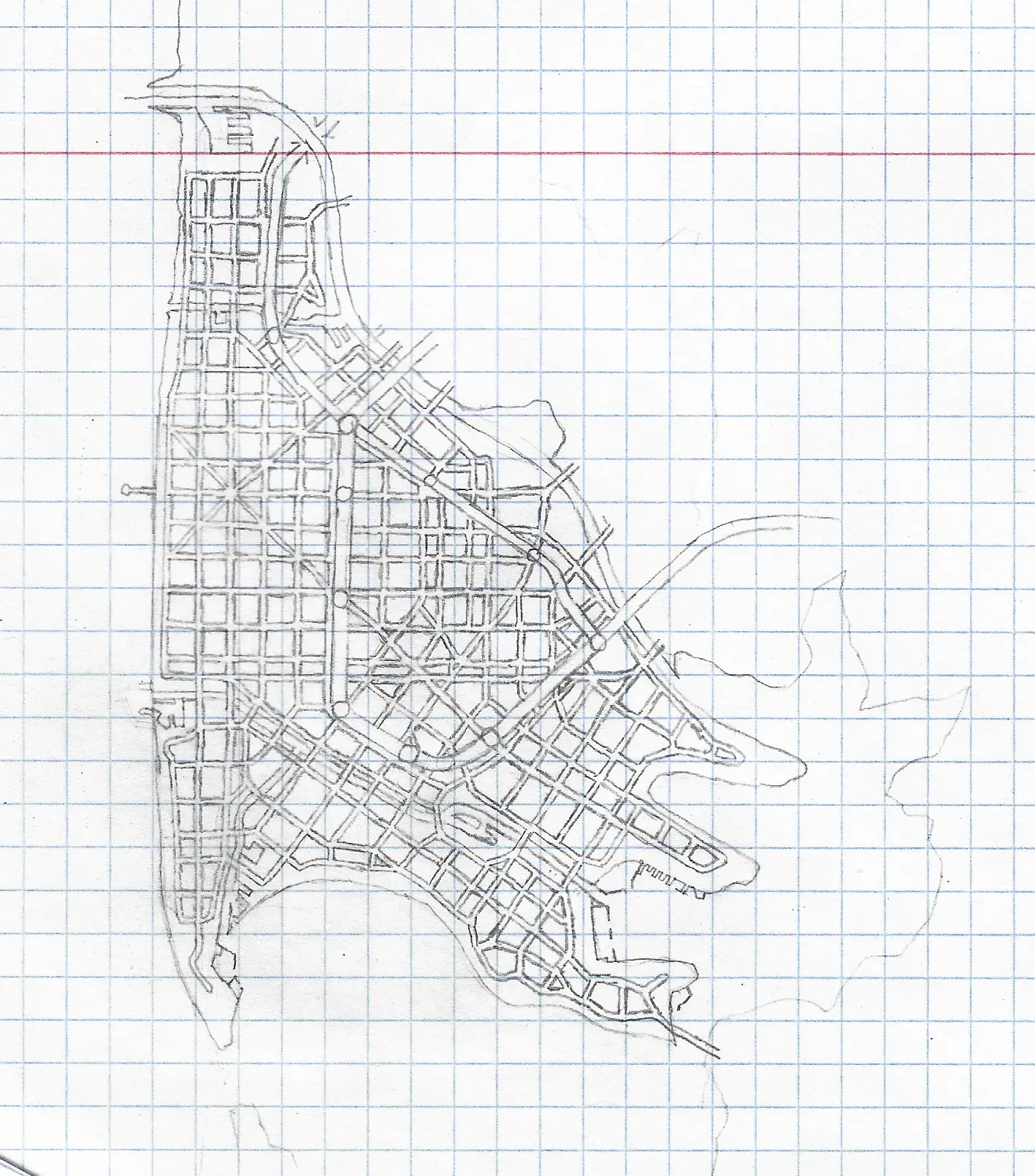
Unnamed city on peninsula
One of my many standard 1cm - 2km scale agglomeration map with no
descriptions. The only thing I can say that the city is supposed to
hold over one milion people, and 1.2 million in the metro area. I
guess it was inspired by either Beirut, Dakar or prehaps Cape Town (at
least location on a large peninsula heading west).
Created:
Bird like island city
That's a nice shaped island, I was wondering around Openstreetmap and
found Norfolk-Virginia Beach area with residential cul-de-sacs on
peninsulas and thought that it must be nice to live on such area.
Created:
no date
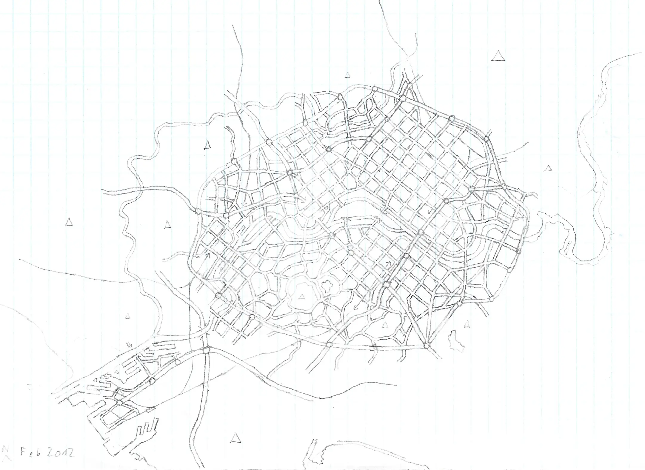
Paris/Rome like city
Paris is its own category when it comes to urban planning. I'm still
impressed of the shape and scale of Boulevard Périphérique - central
Paris ring road. This woefully unfinished city map depicts the mixture
of Paris and Rome. Large port on south-western corner and more than a
7 hills (hardly visible triangles) indicate similarity to Rome, and
mentioned ring road and the flow of the central river looks similar to
the map of Paris.
Created:
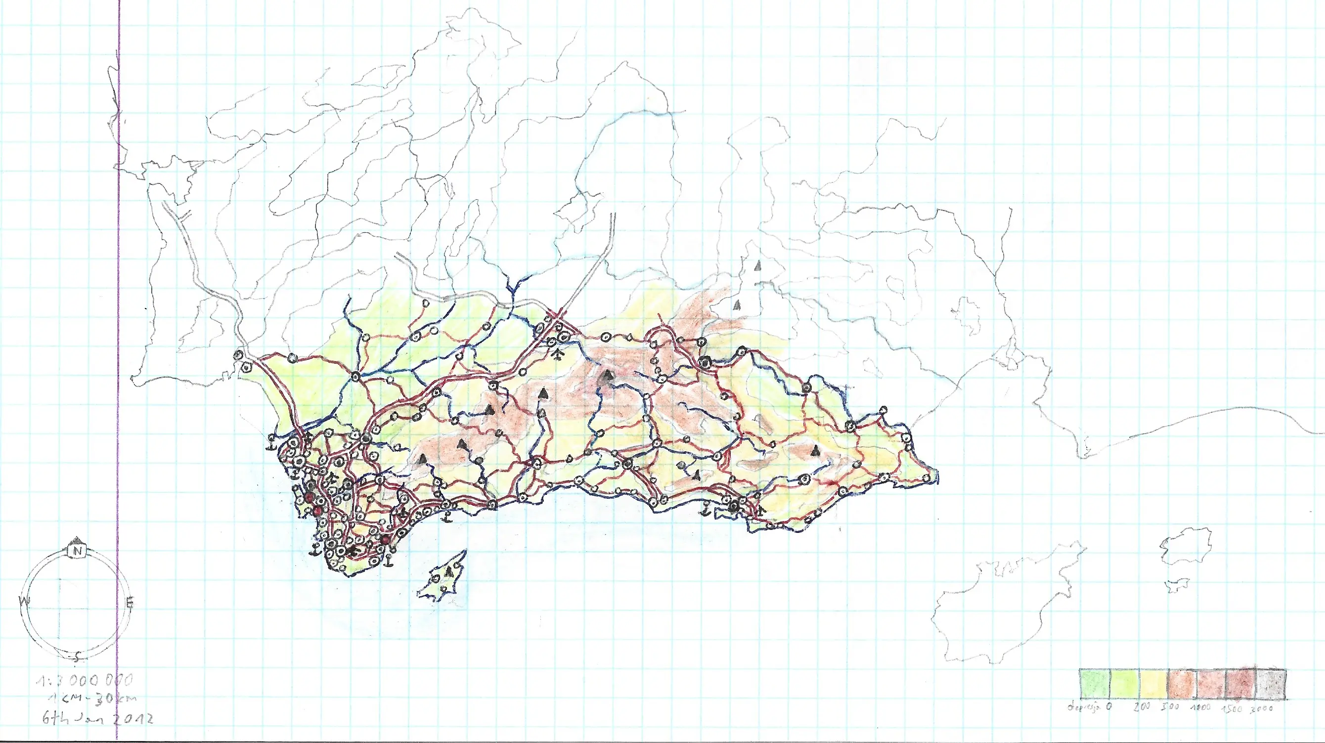
Fictional country based on Andalusia and southern Portugal
For a long time my favourite book ever was a thick world atlas with
detailed maps of almost all the countries of the world (only Papua New
Guinea was unfortunately cut from detailed maps of Oceania for some
reason). The 1 cm = 30 km scale was used often for European maps and
Andalusia part with Cadiz and Malaga was just a nice region to
imitate.
Created:
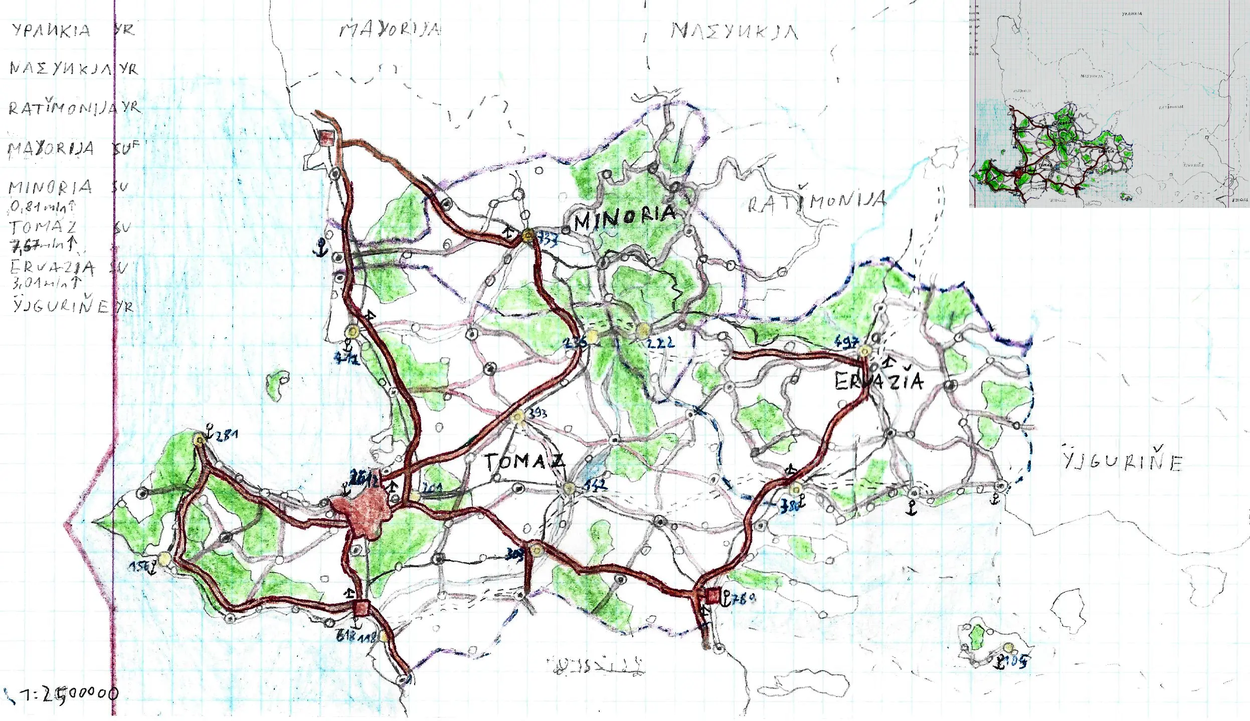
Tomaz Minoria and Eruazia countries
The inspiration of that map should be very clear for all map
enthusiast out there: The Balkans. Just check out all the names of
those countries, in four different scripts, including undeciferable
name at the southermost state. The map was heavily color graded and
cropped, the entire sheet of paper have a lot of blank countries but I
added them at the top right corner.
Created: no date
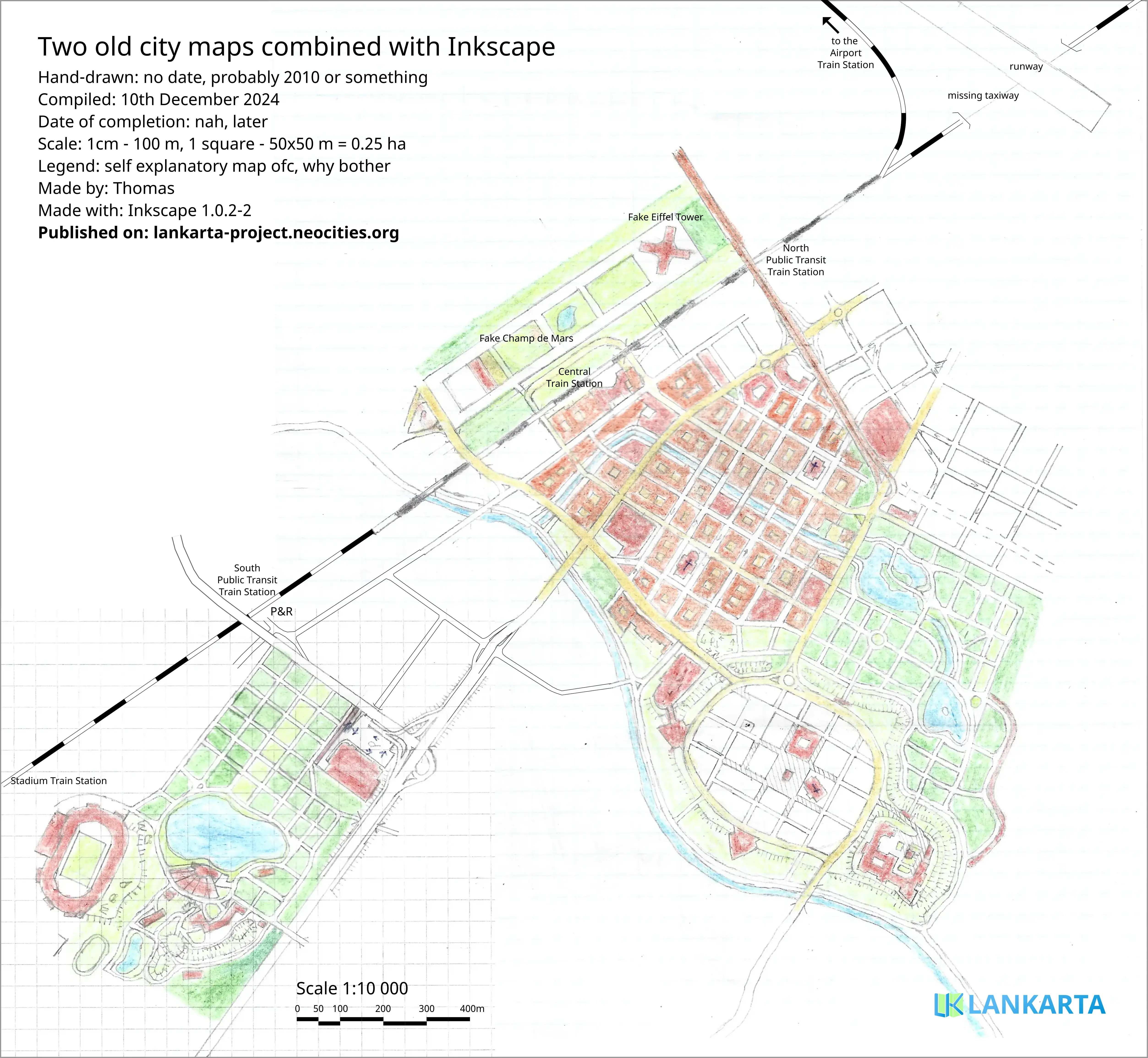
Two combined maps with fake Eiffel Tower
I combined my two small incomplete maps into one larger compiled map,
also incomplete, because I'm lazy. One was the large central and old
city district with a giant park and X shaped building which supposed
to be a replica of the Eiffel Tower and the second map was just a park
with the stadium, now it's on the southwestern edge of the map. I made
that compilation of those two unrelated places because I kinda like
those maps, but when separate, they are too tiny and not publishing
worthy. You can see where each map begins just by looking at the paper
grids, I did not try my best here, but I see how much potential all
those tiny maps have with robust digital tools.
Created: both
maps had no date, Compiled:
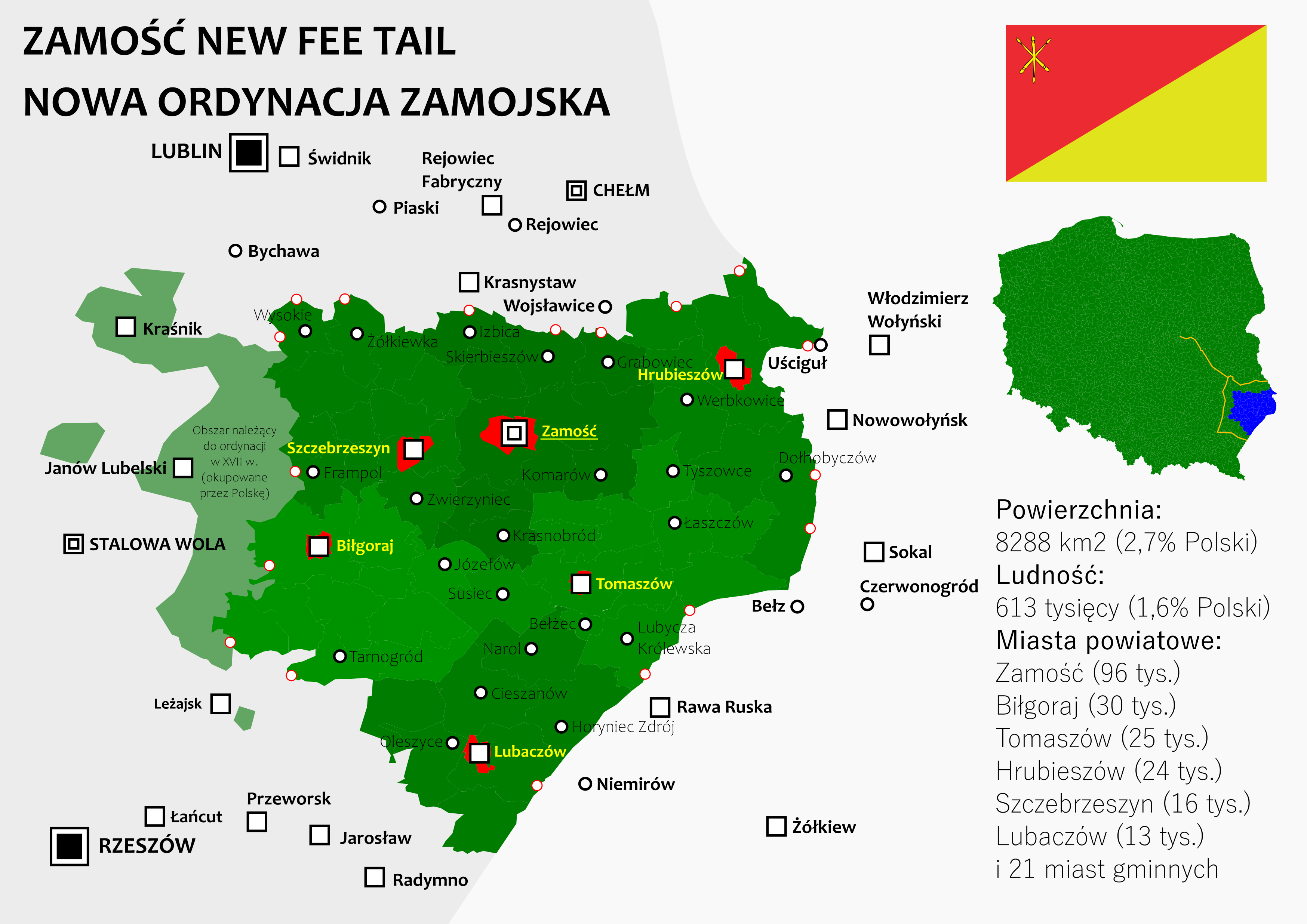
Alternative History of Zamość Fee Tail
Apart from creating completely new lands and cities I used to be an
avid fan of ahistorical maps, so I made a few too. Some of them are
way to cringe to ever show them off in the current geopolitical
situation (you know, the political views and outlook of a teenager is
not that sophisticated), but this one ages quite gracefully.
Zamość Fee Tail
was a land owned by Jan Zamoyski, a powerful aristocrat that found the
city of Zamość in the XVI century. The land was eventually fully
nationalized after the World War II by the Polish People's Republic
but in my fictional version of the history, the fee tail still exists
as a autonomous part of Poland.
In years 1975-1999 Poland used to
be divided by 49 voivodeships, instead of todays 16. After the reform
in 1998 many provincional cities, including Zamość, lost most of its
voivodeship offices which is still viewed by some people as the
degradation of Polish province. This alternative history map colsely
resembles the former Zamość Voivodeship and expands it with Lubaczów
Poviat, which is connected with Zamość by common Roman Catholic
Zamość-Lubaczów Diocese, and the western areas that used to be part of
Zamoyski Fee Tail, but it's ironically signed on the map as "area
owned in XVII century, occupied by Poland".
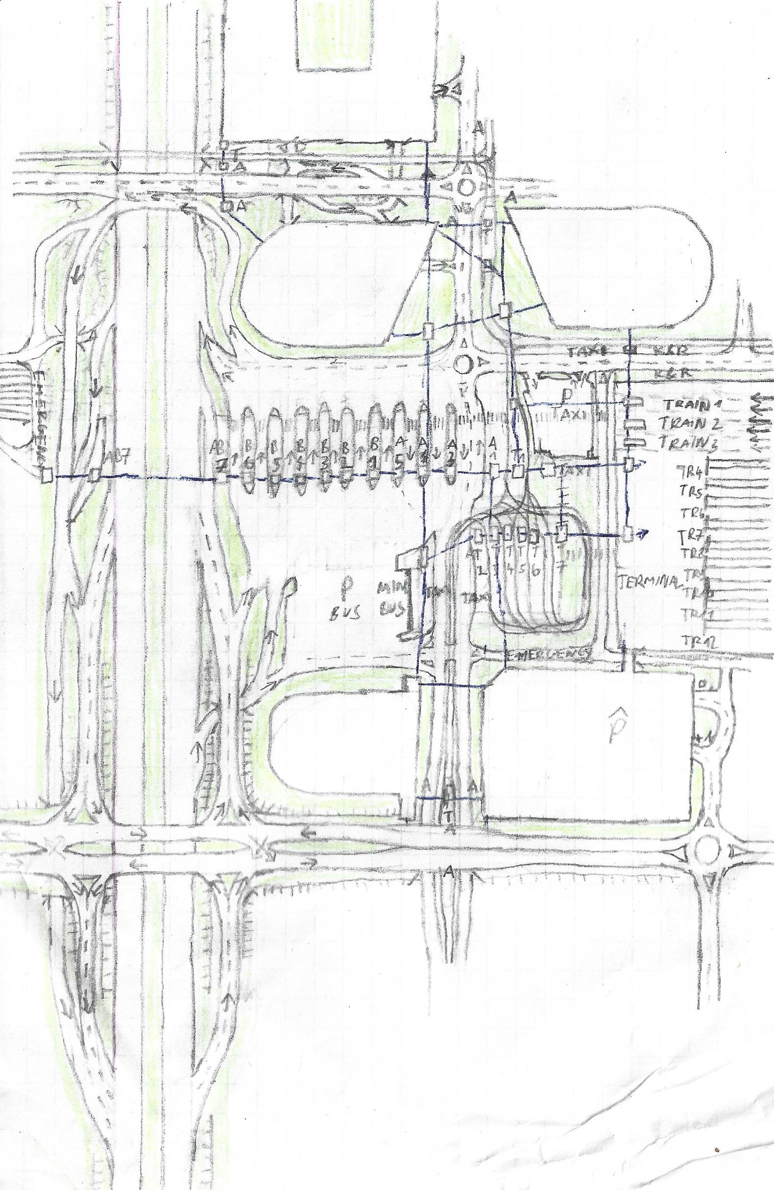
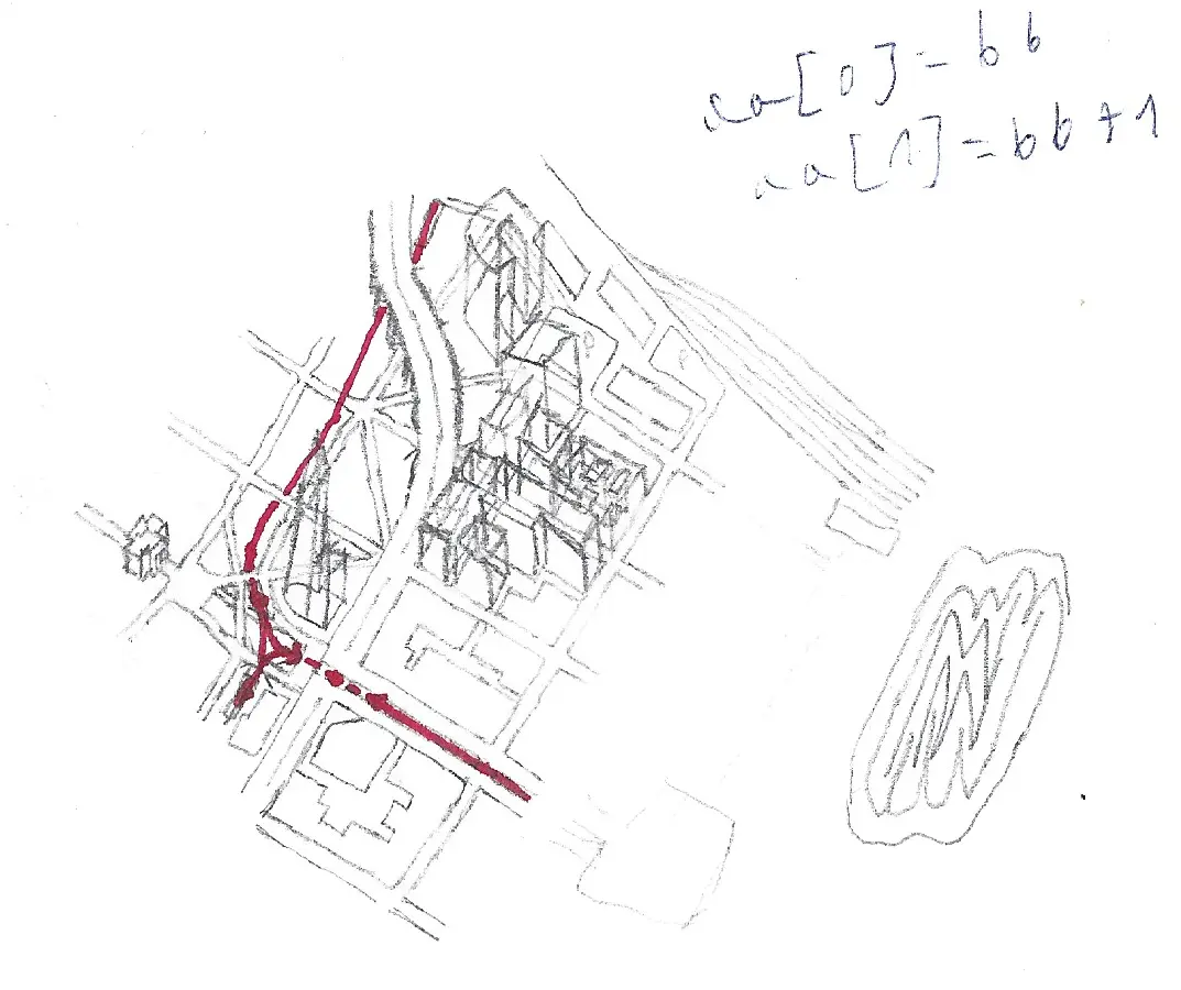
Project of a
Multimodal Transport Hub with diamond
interchange
I was kinda intrigued when I heard about diamond interchanges for the
first time, never seen such a solution in any map in Poland, so I
sketched some transport hub next to a highway to visualize for myself
how it works. This transport hub also includes terminus train station
(on the right) and bus station with multiple parking spots.
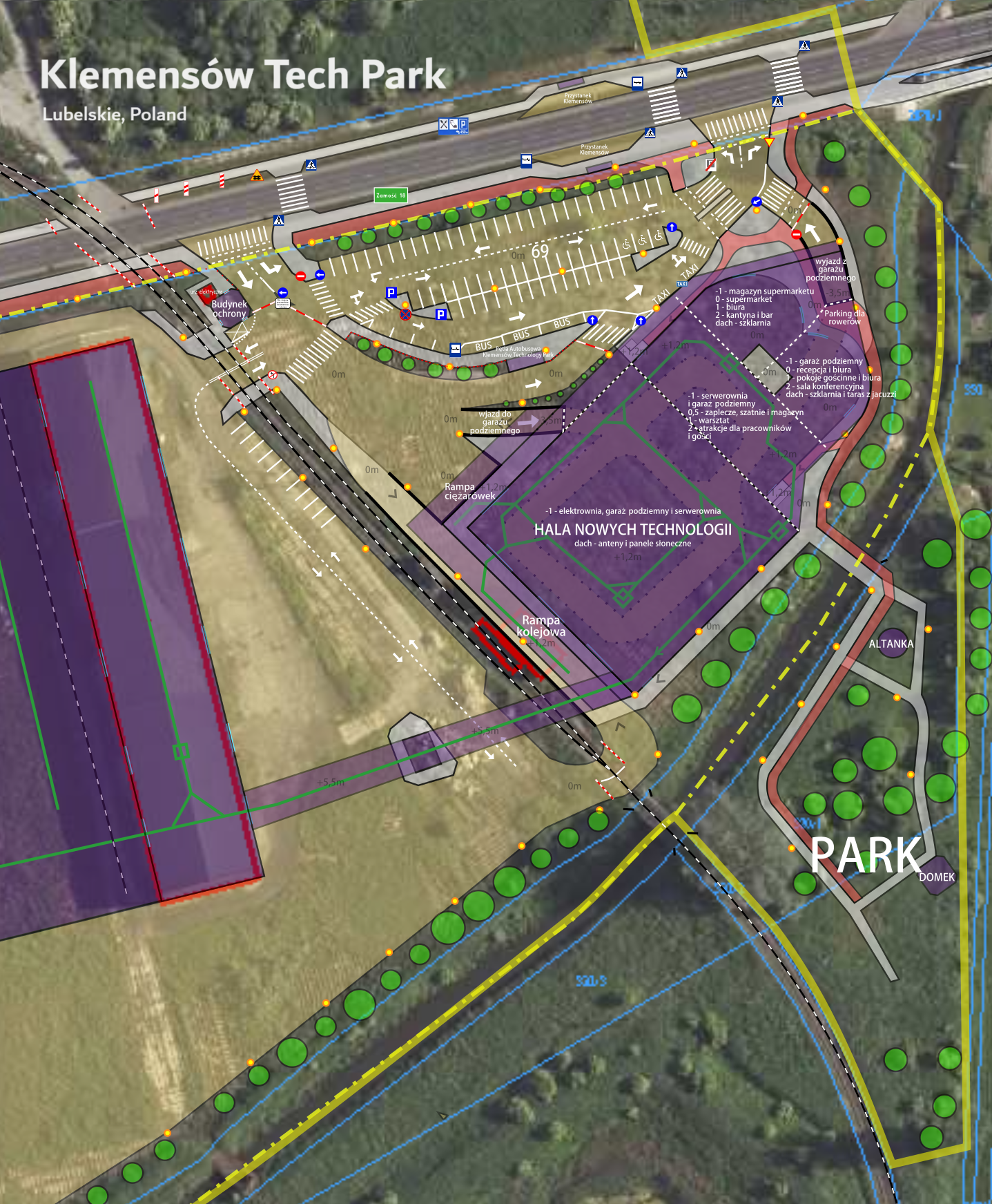
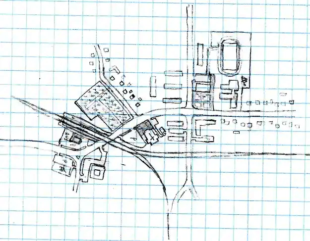
Klemensow Tech Park project
When I get a hand on the basic workflow in Inkscape, I wanted to try
to imitate some infrastructural projects on real satellite images, in
this attempt, I've designed a completely made-up technology campus in
an empty lot of land next to a demolished sugar factory in Lublin
voivodeship in Poland. The long building marked with red line on the
left and the railroad tracks are the only still existing structures in
that area. Right after I uploaded that map on this site I've noticed
that I missed a very important 'no left turn' sign on next to the
eastern exit from the parking, even though I spent a lot of time
designing all those white lanes and signs so the whole parking lot
make sense.
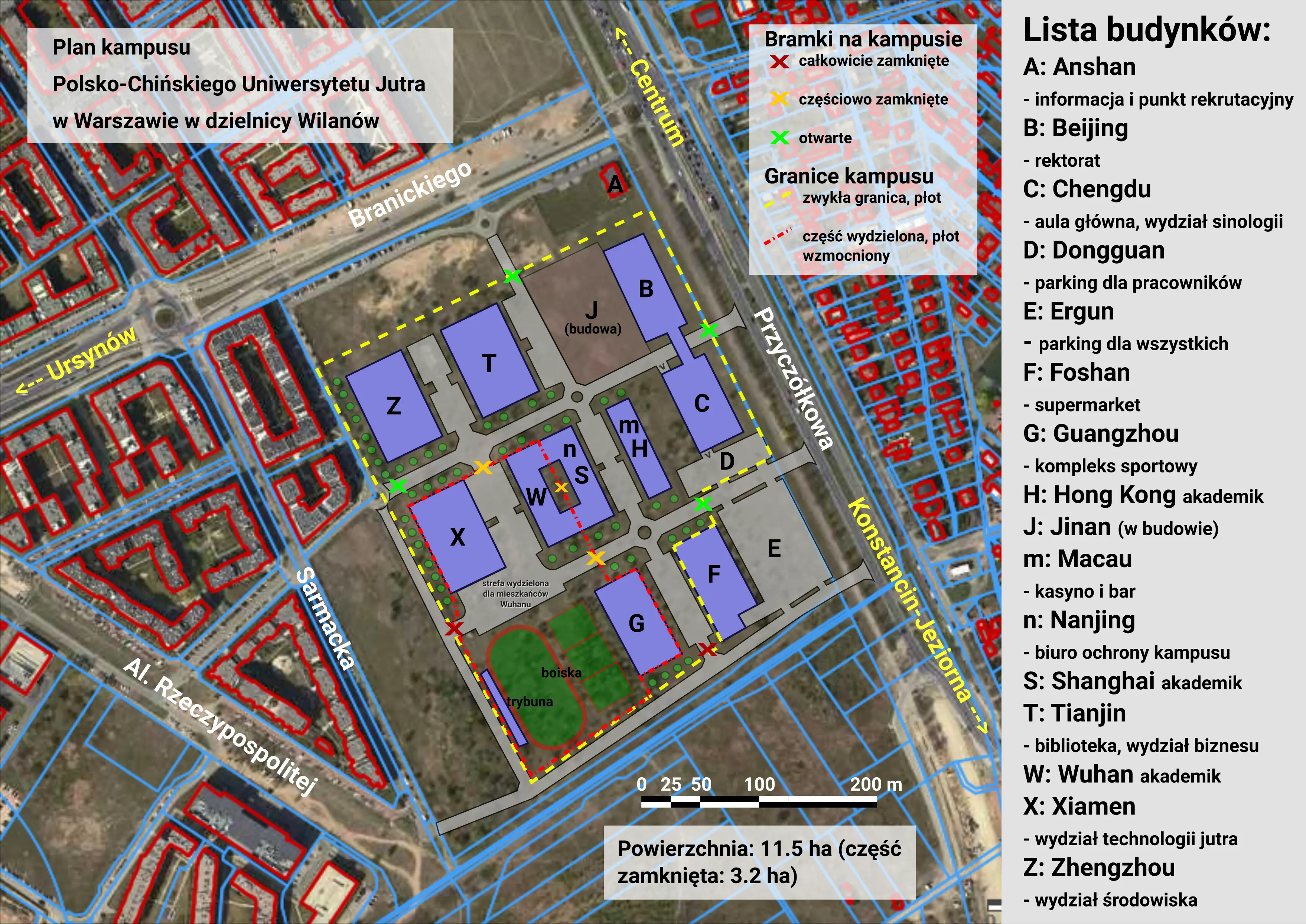
Polish-Chinese University of Tomorrow (PoChUJ) Campus in
Warsaw
During the somewhat enforced covid rules of September 2020 I was
wondering how could it look like if I have been living in foreign
country on university campus. As I had plenty of time on my computer I
started to writing some short horror/cringy series of stories about
life inside tightly sealed from the outside world, large campus of the
fictional Polish-Chinese University of Tomorrow.
The
premise of the series is a isolated life of a large group of men from
various East European and Asian countries, and a very few women as the
university educates mostly highly technical fields of studies and most
of them immidiately run away as fast as the rector's office ruled the
total lockdown. People inside the campus can roam free but under no
circumstances can't get out. All those guys react differently but the
main plot is focused on student government officials (students only)
as now they hold total control over affairs within the area where
instructors only teach remotely. The stories are just a bunch of
drafts and not publish-worthy, but I like the idea of the university
and the campus like that. It was supposed to be symbolic in a bunch of
ways. Each building of the compound is marked by a letter and one of
Chinese city that starts with it. The campus is still brand new but
unfinished and aestetically harsh that somewhat corresponds to the
surrounding newly rich area. The campus is located on an actual empty
lot (not for long) in rapidly urbanising and expensive district of
Warsaw - Wilanów. The alias of the university is an explicit joke
easily understood in Polish.
Created:
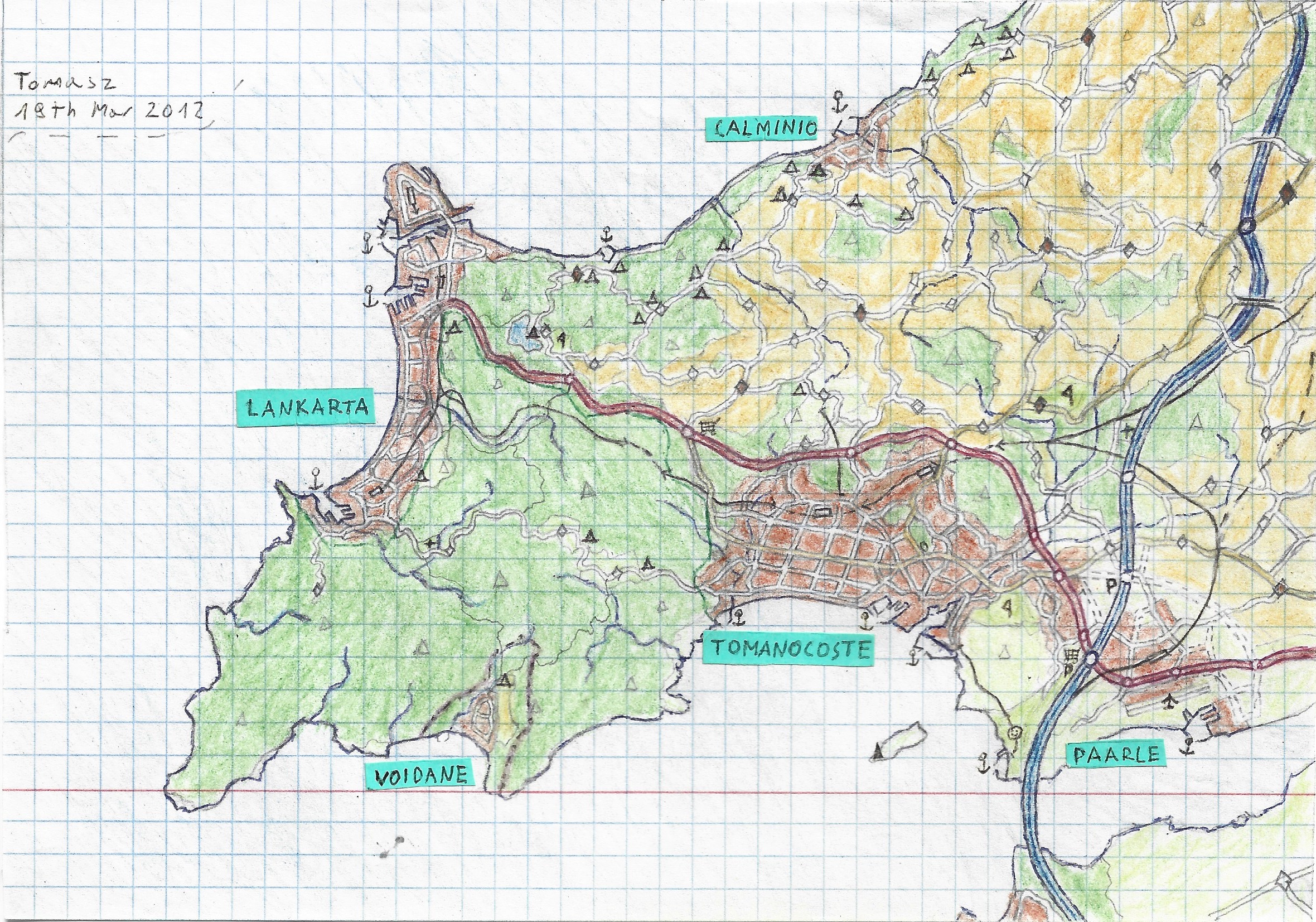
Tomanocoste and Lankarta Region
Most of the time I don't want to clutter the map with random place
names but in this case, on the map of the peninsula surrounded from
three sides by water, I could place city names whefe they don't cover
anything important. That map is the first project when I came up with
the word "Lankarta" which is made of two words: 'Lan' which means just
'Local Area Network', and 'Karta' which means 'Map' in many
indo-european languages. As you may notice, the shape of the peninsula
and the placement of major cities is very similar to the southernmost
large peninsula on Tomanocoste Megacity map shown below.
Created:
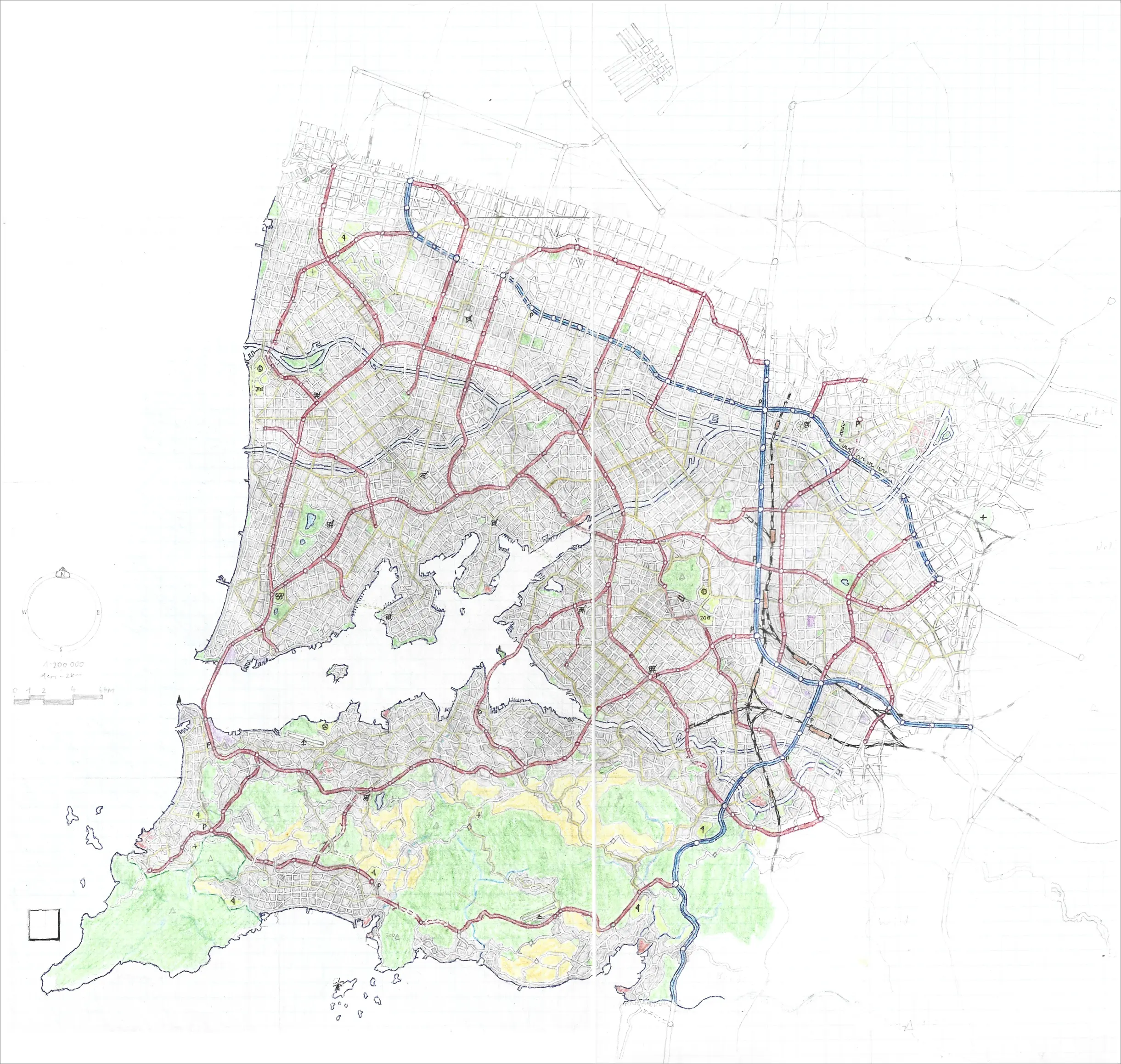
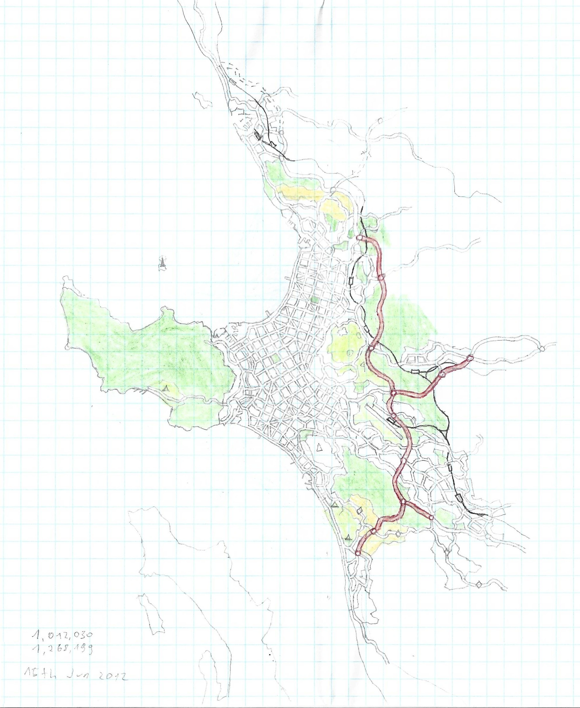
Tomanocoste Megacity
My maps were heavily inspired by a few large scale, sprial bounded
roadmaps, most notably by Poland Map scaled 1cm - 3km and lately by
France and Great Britain roadmaps both scaled 1cm - 2km, which became
my most favourite scale in which I make and read paper maps. This map
of mine was both the largest map by covered area in 1cm - 2km scale
and the largest, yet sadly unfinished, map by the physical size of the
canvas, as it was originally drawn in two A3 sheets taped together.
The scan is cut out of the top as it was only a large section of
completely empty area further north of the unfinished multi-runway
airport. The megacity was expected to be inhabited by almost 20
million people.
Created: March -
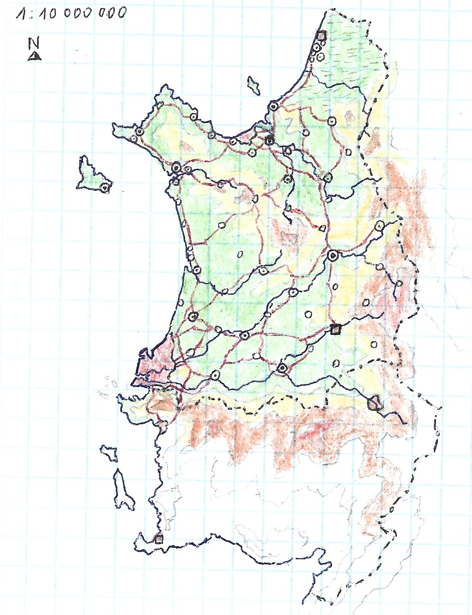
The Country of Mangaria
(hand-drawn)
If you take a look a bit closely into this map you may find out that
the megacity of Tomanocoste from the previous map is right on the
southwest coast of Mangaria, which is yet another fictional country
that I've made and obviously not finished.
Created:
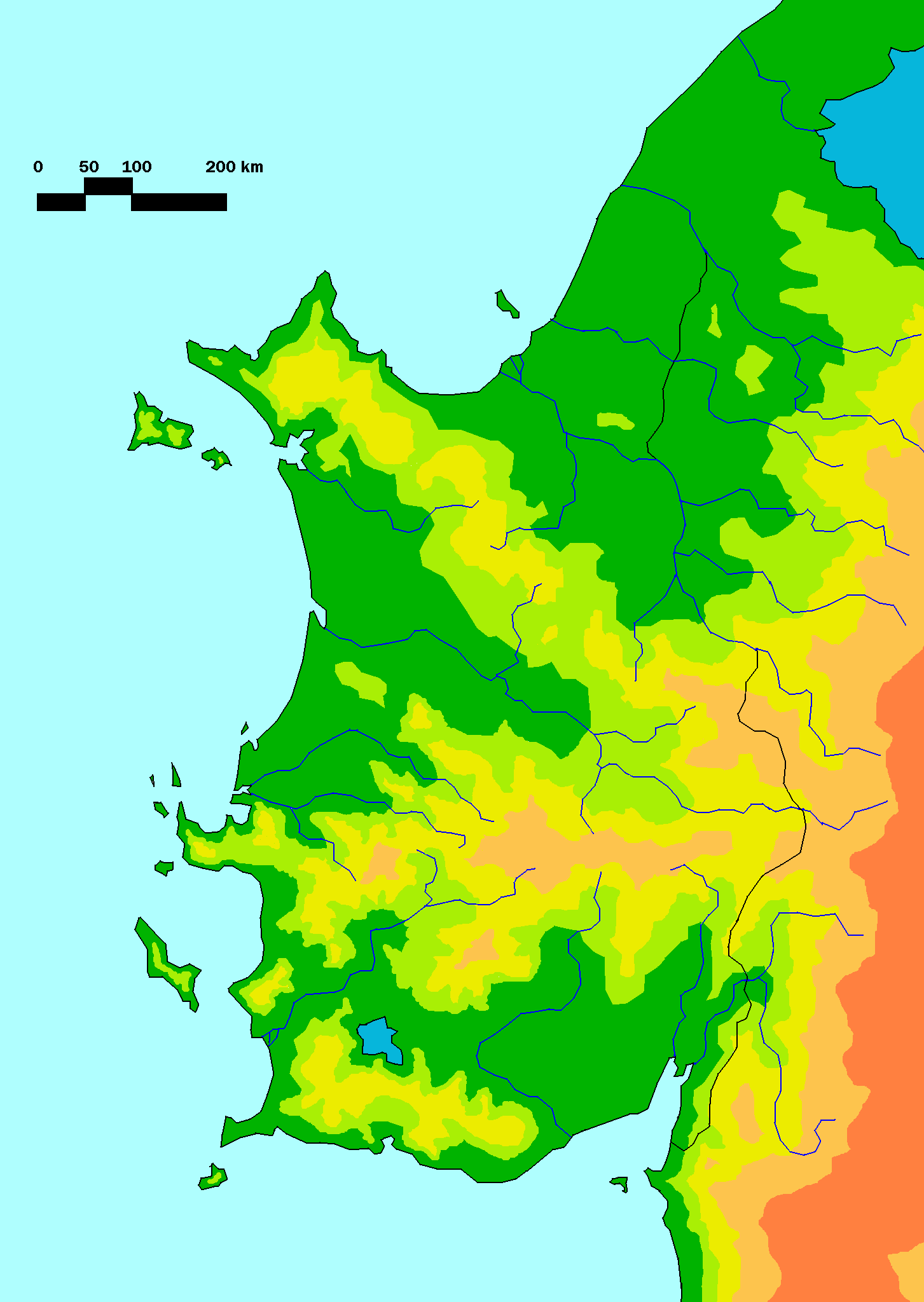
Physical Map of Mangaria and the surrounding areas
(digitalized)
That map is one of my first attempts to digitalized my hand-drawn
maps. As you can see, my methods were fairly primitive, that was the
time when I didn't even know Inkscape existed. Also the layout of
mountain ranges were much altered in digital version for a reason that
I don't remember, probably to make north and south more unified.
Created:
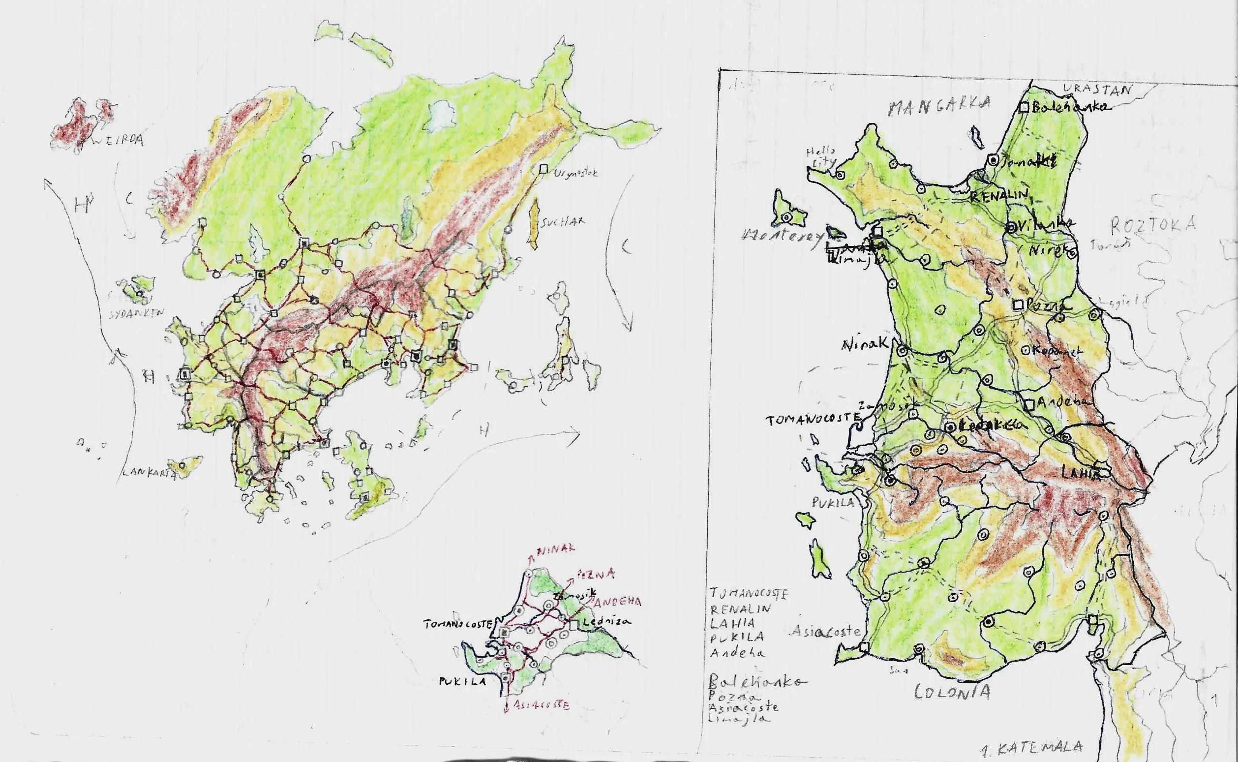
Mangarka Continent with detailed region
of Tomanocoste
From the map of surrounding areas of Tomanocoste, to the entire
continent with various countries, height map, even ocean currents,
there is a serious worldbuilding going on that map. I don't know why
the country where Tomanocoste is located is misspelled as 'Mangarka',
I guess I'll just name the entire continent by that, why not. That the
map with in which have the most names out of all the maps of
Tomanocoste series, now you can see how other places and cities were
supposed to be called. Oh and I love how that mountainous (red
colored) archipelago is named 'Weirda'.
Created: